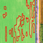
IntelinAir has announced the release of an analytics engine for high-resolution aerial imagery of agricultural fields. In a release the company writes that last year their AgMRI engine analyzed over 50 TB of imagery from millions of acres of corn and soybean fields in Illinois and Iowa. This analysis alerted growers to issues impacting yields and input decisions. “We’re … [Read more...] about IntelinAir Announces Analytics Platform for High-Resolution Aerial Imagery
- Skip to main content
- Skip to secondary menu
- Skip to primary sidebar
- Skip to secondary sidebar
- Skip to footer


