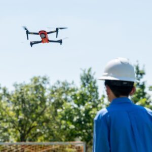
Hands-on Flight Experience and FAA Certification Prepare Students for Careers in Civil Engineering and Beyond by DRONELIFE Features Editor Jim Magil Students enrolled at a new drone training program at the University of Texas at Arlington will have the opportunity to not only study to earn a Part 107 license, but will also get hands-on experience piloting UAVs. The … [Read more...] about UT Arlington Launches Drone Program to Train Future Pros
construction technology
New Oceanographic Survey Drone Can Take Off, Land, and Sail on the Water
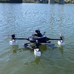
This article published in collaboration with JUIDA, the Japan UAS Industrial Development Association. Penta Ocean Construction (President, Takuzo Shimizu) and Prodrone Co., Ltd. (President, Shunsuke Toya) have jointly developed the "Penta-Ocean Vanguard-DroneAqua" (POV-DA), an innovative oceanographic survey drone capable of taking off, landing, and sailing on the … [Read more...] about New Oceanographic Survey Drone Can Take Off, Land, and Sail on the Water
SkyeBrowse Unveils Major Update for Faster 3D Modeling
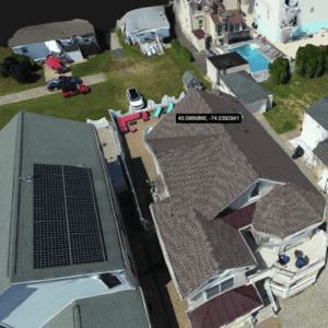
Enhanced Processing Speed and New GPS Feature Boost Accuracy for Construction, Surveying, and Public Safety by DRONELIFE Staff Writer Ian J. McNab Telemetry software developer SkyeBrowse recently announced a major update to their flagship product, bringing them substantially closer to their stated goal of creating truly real-time 3D models using UAV assets. As part of these … [Read more...] about SkyeBrowse Unveils Major Update for Faster 3D Modeling
Pix4D Releases Enhanced PIX4Dcatch 2.0 with AR Features
Latest update integrates professional augmented reality tools for improved precision in AEC sectors. Swiss-based Pix4D, a leading provider of drone and terrestrial mapping solutions, announced today the release of the upgraded version of their mobile scanning app, PIX4Dcatch 2.0. This update introduces augmented reality (AR) capabilities and expands compatibility with … [Read more...] about Pix4D Releases Enhanced PIX4Dcatch 2.0 with AR Features


