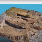
Creating 3D models and maps from aerial footage isn't a new idea. Sophisticated, survey grade models from satellite and aircraft images have been used for large scale environmental surveys, construction projects, and other applications. That functionality is incredibly valuable - and until recently, reserved for government and large industry due to the expense. Drones, … [Read more...] about Mapping from a Drone vs. Mapping from Manned Aircraft or Satellite Data: The Difference is Getting Smaller All the Time with SimActive
- Skip to main content
- Skip to secondary menu
- Skip to primary sidebar
- Skip to secondary sidebar
- Skip to footer


