
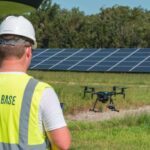
Showcasing Innovations in Stabilization and Connectivity Gremsy and Nokia are teaming up to present their latest UAV integration solutions at XPONENTIAL Europe 2025. The event, known for bringing together experts in unmanned and autonomous systems, provides a platform to explore new advancements and industry challenges. This collaboration highlights ongoing efforts to improve … [Read more...] about Gremsy and Nokia Unveil UAV Integration Solutions at XPONENTIAL Europe 2025
aerial imaging
Two Innovative Canadian Drone Companies Join Forces to Fight Kelowna Wildfires
As wildfires raged in Canada, two innovative Canadian drone companies joined forces to provide responders with critical aerial data. InDro Robotics and Spexi Geospatial deployed commercial off the shelf drones weighing less than 250 grams, using the Spexigon automation platform, to provide decision makers with rapid damage assessment information and thermal imagery identifying … [Read more...] about Two Innovative Canadian Drone Companies Join Forces to Fight Kelowna Wildfires
DroneBase Investment Continues: $20 Million Raise for Renewable Energy
DroneBase Investment: Company Raises $20 Million for Renewable Energy and Global Growth by DRONELIFE Staff Writer Ian M. Crosby DroneBase, the leader in Intelligent Aerial Imaging, has raised a further $20 million in just under five months after bringing in $12.5M in its Series C round, with the new round led by Euclidean Capital. The funding will enable the company's … [Read more...] about DroneBase Investment Continues: $20 Million Raise for Renewable Energy
Delair and Geosys Partner on Precision Agriculture
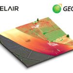
French enterprise drone manufacturer and aerial data provider Delair and Geosys, a specialist in satellite and weather data analytics for agriculture, have announced a partnership to expand data gathering and analysis in precision farming. The result of the partnership will be a single analytics platform that integrates drone and satellite data for agriculture companies … [Read more...] about Delair and Geosys Partner on Precision Agriculture
DroneDeploy Upgrades Live Map Platform for Better UAV Imaging

Four months after releasing a real-time UAV mapping solution, software startup DroneDeploy is enhancing the system with the release of Thermal Live Maps. In February, the company launched Live Map, a product described as the “only real-time drone mapping solution in the world.” Thermal Live Maps, DroneDeploy officials say, now allows users to generate thermal drone maps … [Read more...] about DroneDeploy Upgrades Live Map Platform for Better UAV Imaging


