Pix 4D is expanding their enterprise toolset beyond their mapping roots - although the Pix4DMapper platform continues to evolve and improve, staying out ahead of the curve in accuracy and processing time. Now, the company announces the addition of a totally new generation of tools to the Pix4D suite: Pix4Dsurvey, Pix4Dmatic, Pix4Dinspect, and Pix4Dscan. See the video below … [Read more...] about Pix4D Launches Next Gen Suite of Tools [Video]
aerial imagery
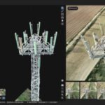
DroneBase & Airbus Aerial Partner to Combine Drone and Satellite Imagery

Airbus Aerial and DroneBase have announced a partnership that will be interesting reading for any organization that relies on aerial imagery to make better decisions. The two plan to deliver the world’s first "multi-source data service solution for aerial imagery and data from a single provider". In English, that means the companies will seek to offer a combined service that … [Read more...] about DroneBase & Airbus Aerial Partner to Combine Drone and Satellite Imagery


