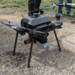
Aerial LiDAR surveys aren't new technology - but now U.S. - based Harris Aerial has demonstrated a new and ground-breaking way of performing them. LiDAR surveys provide critically accurate survey data, allowing for the creation of precise 3D models. LiDAR attached to a helicopter or other manned aircraft have been used for over 50 years in applications like natural hazard … [Read more...] about Endurance Flight without a Helicopter: Drone Tech Firm Harris Aerial Demonstrates LiDAR with Carrier H4 Hybrid
- Skip to main content
- Skip to secondary menu
- Skip to primary sidebar
- Skip to secondary sidebar
- Skip to footer


