Guest post DroneDeploy How To Decide If Your Drone Mapping Project Needs GCPs Ground control points (GCPs) can be an invaluable tool for aerial mapping. When used correctly, they help ensure a high degree of global accuracy, which is important for most surveying and construction projects. But the fact is, the majority of drone maps don’t require GCPs. Because of … [Read more...] about Drone Analytics: When to Use Ground Control Points
Surveying
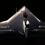
xCraft Launches VTOL Mapping Drone x2 Geo
Idaho drone manufacturer xCraft has announced the launch of its latest VTOL drone, the x2 Geo. The x2 Geo will be offered to professionals as part of an alternative mapping solution, using VTOL technology to preserve battery life and increase flight time. xCraft's new drone comes after the successful launch of the xPlusOne, as well as upcoming products the Rogue racing drone … [Read more...] about xCraft Launches VTOL Mapping Drone x2 Geo
Parrot Repurposes Consumer Models for Commercial Market
French drone manufacturer Parrot has taken an interesting sideways step into the commercial market this week. The company has announced that two of its latest consumer drones are being repurposed to meet the needs of professionals in agriculture, mapping and inspection, for industries ranging from construction to real estate. Parrot announced that more than a third of its … [Read more...] about Parrot Repurposes Consumer Models for Commercial Market
New Fixed-Wing Drone from Sentera for Agriculture, Surveys, Search and Rescue
Sentera has introduced an enhanced Phoenix fixed-wing drone product line that can be adapted to to support the precision agriculture, mapping, and public safety industries. It is a solution that Sentera markets as cost-effective solution, easy to fly, accepts a variety of payloads, and covers more acres in less time than competitive options. A complete solution with payload … [Read more...] about New Fixed-Wing Drone from Sentera for Agriculture, Surveys, Search and Rescue
Atlanta Airport Tasks Drones for Survey Missions
Drones and airports don’t usually mix. In fact, most airport officials are working on ways to keep drones away. For Hartsfield-Jackson Atlanta International Airport, however, survey drones are improving a multi-billion project from above. Earlier this month, officials announced that ATL, the world’s busiest airport, received FAA certification to fly an Intel Falcon 8 UAS … [Read more...] about Atlanta Airport Tasks Drones for Survey Missions


