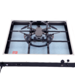
Heisha Technology wants to be the go-to charging component for autonomous drone solutions: and they're well on the way. With it's C500 Plus release, the company is targeting drone system integrators with their new charging platform. As the drone industry matures, end-to-end solutions now often use a variety of components, bundled by system integrators into a branded … [Read more...] about Heisha Technology Wants To Be The Go To Charging Platform for Autonomous Drone Solutions [VIDEO]
Sponsored Content
DroneLogBook Wants to Take Care of the Compliance for You: Simplifying End-to-End Drone Operations
Enterprise adoption of drone technology - either outsourced or in-house - is a great development for the industry. Enterprise programs, however, require high levels of operational oversight and regulatory compliance. Some programs have had to develop - and then endlessly upgrade and maintain - their own systems to accommodate. Others have had to put together a piecemeal … [Read more...] about DroneLogBook Wants to Take Care of the Compliance for You: Simplifying End-to-End Drone Operations
Pix4D announces Stand-Alone Photogrammetry with Cloud Processing
Pix4D launches stand-alone photogrammetry cloud processing solutions Lausanne, Switzerland, June 9th, 2020: Pix4D, the photogrammetry and drone-mapping industry leader, announces today the release of Pix4Dcloud and Pix4Dcloud Advanced: the new mapping platforms for online surveying workflows and construction site monitoring. These stand-alone cloud products run Pix4D’s … [Read more...] about Pix4D announces Stand-Alone Photogrammetry with Cloud Processing
SimActive Introduces Cloud Sharing and Reflectance Calibration
Montreal, Canada, June 9th, 2020 – SimActive Inc., a world-leading developer of photogrammetry software, announces the release of Correlator3D version 8.5. The new version allows users to share and visualize projects in the cloud. It also features new tools for the calibration and processing of multispectral imagery. Specifically, results can be exported to the cloud … [Read more...] about SimActive Introduces Cloud Sharing and Reflectance Calibration
Drone Mapping of UNESCO Archaeological Site
Drones mapping of UNESCO Archaeological sites are helping to gather the necessary data to help prepare orthophoto maps and digital elevation models of valuable areas. The drone mapping company SimActive recently announced that it is involved in the mapping of a UNESCO Archaeological site of Halin in Myanmar. This is located in the country of Burma. The goal of the … [Read more...] about Drone Mapping of UNESCO Archaeological Site


