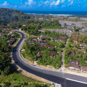
As governments invest in infrastructure to unlock tourism and regional growth, the challenge is no longer just building roads. It is building roads that can endure terrain, climate, and time. A recent case study from Blue Marble Geographics demonstrates how drone-based photogrammetry and watershed modeling are helping engineers design a more resilient transportation corridor … [Read more...] about Designing Resilient Roads on Java’s Southern Coast: A Blue Marble Geographics Case Study
Mapping Technology
Woolpert and Saildrone Deploy Autonomous USV for NOAA Seafloor Mapping Near Mariana Islands
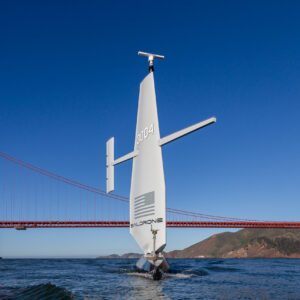
Woolpert and Saildrone have partnered to collect and process bathymetric survey data for NOAA's Ocean Exploration and Office of Coast Survey. The mission supports safe navigation and ocean mapping initiatives, including the National Strategy for Mapping, Exploring, and Characterizing the United States Exclusive Economic Zone and the Seabed 2030 initiative. The … [Read more...] about Woolpert and Saildrone Deploy Autonomous USV for NOAA Seafloor Mapping Near Mariana Islands


