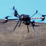
PG&E Explores Cutting-Edge Drone Technology to Elevate Utility Operations Pacific Gas and Electric Company (PG&E) (NYSE: PCG) orchestrated a comprehensive conference today, uniting certified drone pilots, industry collaborators, community partners, and federal stakeholders to delve into the myriad applications of unmanned aerial systems for utility operations. … [Read more...] about PG&E Revolutionizing Utility Operations Through Cutting-Edge Drone Technology: Beyond Inspections
Industries
Drones, Digital Twins, and Asset Digitization: vHive Wins 2023 Enabling Technology Leadership Award
Today, vHive, a global market leader specializing in enterprise asset digitization, announced it has been recognized by Frost & Sullivan as a recipient of the 2023 Enabling Technology Leadership Award. This award recognizes vHive as a leading Digital Twins software solution provider for multiple industries, including telecom, renewable energy, and cranes, based on its years … [Read more...] about Drones, Digital Twins, and Asset Digitization: vHive Wins 2023 Enabling Technology Leadership Award
GeoCue Partners with Tediris to Integrate TrueView 3D Imaging with Aero 4 Drone
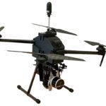
GeoCue and Tediris Solutions Partner to Provide Spain with Aerial Mapping Solutions by DRONELIFE Staff Writer Ian M. Crosby LiDAR mapping leader GeoCue has announced a new partnership with Spanish drone service provider Tediris Solutions. With close to a decade of experience in the UAV market, Tediris Solutions integrates sophisticated sensors, drones, and artificial … [Read more...] about GeoCue Partners with Tediris to Integrate TrueView 3D Imaging with Aero 4 Drone
Retrofitting Cities for Air Taxis: Are Waterfront Vertiports the Future of Advanced Air Mobility?
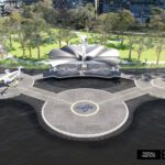
Skyportz®, Contreras Earl Architecture and Pascall+Watson Architects will release a concept for an Australian waterfront e-mobility hub at the World Air Taxi Congress in San Francisco. Continue reading below, or listen: DroneLife · Waterfront - Vertiports - The - Future - Of - Advanced - AIr - Mobility The group proposes that waterfront vertiports are a logical solution for … [Read more...] about Retrofitting Cities for Air Taxis: Are Waterfront Vertiports the Future of Advanced Air Mobility?
NC DOT to Deploy Remote Drone Operations at Construction Sites: the Path to Routine, BVLOS Inspections
NC DOT Wins FAA Waiver for Remote, BVLOS Ops at Construction Sites Continue reading below, or listen: DroneLife · NC - DOT - Receives - FAA - BVLOS - Waiver - For - Remote - Inspections NC has been a leader in advancing drone operations. Now, the NC DOT announces an FAA waiver to remotely launch and fly drones beyond visual line of sight (BVLOS) to inspect the agency's … [Read more...] about NC DOT to Deploy Remote Drone Operations at Construction Sites: the Path to Routine, BVLOS Inspections


