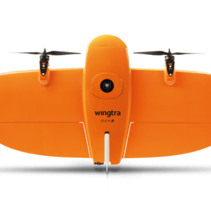
New Payload Slashes Time and Boosts Efficiency for Complex Survey Projects by DRONELIFE Staff Writer Ian J. McNabb At InterGeo this week, Switzerland-based drone manufacturer Wingtra recently announced their new MAP61 mapping payload, which they describe as “the most efficient mapping sensor on the market”. Able to capture up to 1,140 acres in a single flight, the MAP61 is … [Read more...] about Wingtra Unveils MAP61: The Game-Changing Mapping Payload Redefining Survey Efficiency
Featured - Surveying
North Carolina Drone Photographer Seeks Supreme Court Support for First Amendment Rights
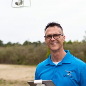
Michael Jones asks the court to uphold his right to provide aerial information to clients. Yesterday, the Institute for Justice (IJ) filed a petition with the United States Supreme Court on behalf of Michael Jones, a drone photographer in North Carolina. The case brings forward an important question: does providing data and information through aerial photographs qualify as … [Read more...] about North Carolina Drone Photographer Seeks Supreme Court Support for First Amendment Rights
New Drones in India: Surveyaan V1 Receives Certification
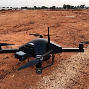
Surveyaan V1 Drone by Nibrus Technologies Receives DGCA Type Certification New Certification Marks a Milestone for India's Drone Industry Nibrus Technologies, a drone manufacturer in India, has announced that its Surveyaan V1 drone has received Type Certification from the Directorate General of Civil Aviation (DGCA). This accomplishment represents a significant achievement … [Read more...] about New Drones in India: Surveyaan V1 Receives Certification
North Carolina Drone Operator to Seek Further Review in First Amendment Lawsuit
Appeals Court Upholds Ban on Aerial Mapping by Non-Surveyors A three-judge panel of the 4th U.S. Circuit Court of Appeals has ruled that North Carolina can prohibit the creation of aerial maps by anyone other than licensed land surveyors. This decision affects Michael Jones, a drone operator based in Goldsboro, North Carolina, as well as other entrepreneurs in the state. … [Read more...] about North Carolina Drone Operator to Seek Further Review in First Amendment Lawsuit
Advanced Mapping Techniques Reach New Heights in the Himalayas

SimActive's Correlator3D Software Empowers NEPC to Overcome Geographic Challenges In a significant technological stride, SimActive Inc., a leader in photogrammetry software development, facilitated comprehensive mapping projects in the daunting terrains of the Himalayas through its Correlator3D™ software. This pioneering venture was carried out by Nektor Engineers and Project … [Read more...] about Advanced Mapping Techniques Reach New Heights in the Himalayas


