
inUAVi, a start-up in the drone radio frequency monitor and sensor market, has announced the availability of an RF measurement instrument for use from drones that collects and relays data in real time to the drone operator from an application integrated with the drone's operating system. "We're excited to introduce our advanced electronic sensors and payloads that are … [Read more...] about inUAVI Releases RF Measurement Instrument for Real Time Data Relay from Drones
Sensors
Sentera Adds Data Capture Options to DJI Phantom 4s
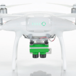
Double 4K Sensor's fully customizable filters offer impeccable crop health insights Sentera has announced its Double 4K precision agriculture sensor is now available on DJI Phantom 4 Professional, Advanced, and Standard drones. This offering provides Double 4K quality at entry-level pricing, expanding late-season data collection options for agronomists, crop … [Read more...] about Sentera Adds Data Capture Options to DJI Phantom 4s
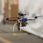
Aerotenna Demonstrates Collision Avoidance in Drones with Texas Instruments Sensors
Aerotenna has successfully demonstrated collision detection and avoidance in drones with the IWR1642 mmWave sensor from Texas Instruments (TI), and announced its commitment to feature TI mmWave sensors in its next-generation collision-avoidance solution, uSharp Patch D1. As a leading provider of autonomous flying solutions for drones, Aerotenna sees TI IWR1642 sensor real-time … [Read more...] about Aerotenna Demonstrates Collision Avoidance in Drones with Texas Instruments Sensors
Draper Equips High Speed UAVs with Vision for GPS-denied Navigation
The following release is from Draper, an engineering firm based in Cambridge, MA. The company is developing technology that will enable UAVs to navigate autonomously through indoor environments where GPS signals are unavailable. CAMBRIDGE, MA—Aug. 4, 2017—When a firefighter, first responder or soldier operates a small, lightweight flight vehicle inside a building, in urban … [Read more...] about Draper Equips High Speed UAVs with Vision for GPS-denied Navigation
Icaros and TeAx Deliver Drone Mapping Solution for Radiometric ThermalCapture Sensors
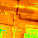
Icaros Inc., a provider of aerial imaging software, has announced that its drone image processing software can now process Thermal IR images from Radiometric microbolometer sensors. Icaros’ OneButton family for drone image processing lets end users generate geospatially precise, fully orthorectified 2D maps and 3D models from frame-based aerial imaging systems. The OneButton … [Read more...] about Icaros and TeAx Deliver Drone Mapping Solution for Radiometric ThermalCapture Sensors


