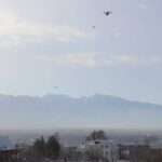
Utah-based Fortem Technologies, which launched in 2016 and now counts Boeing’s HorizonX among its investors, last week demonstrated its counter drone technology for legislators at the Utah State Capitol building in Salt Lake City. The company's countermeasure combines its SkyDome platform - which provides situational awareness - with the DroneHunter, a menacing DJI M600 … [Read more...] about Fortem’s DroneHunter Turns DJI’s M600 Against Its Own
Airbus Publishes Study into Public Perception of Urban Air Mobility
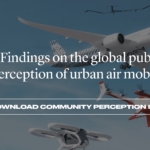
Airbus - one of several players in the race to make Urban Air Mobility (UAM) a reality - has delved into how open the public is to the idea of getting from A to B using unmanned aircraft. The report can be read in full, here. The study's headlines are fairly positive. The researchers put questions to respondents in four locations around the world: Los Angeles, Mexico … [Read more...] about Airbus Publishes Study into Public Perception of Urban Air Mobility
Flock Launches Monthly Drone Insurance Coverage
UK insurtech startup Flock has launched a monthly subscription product, Fly Unlimited, to provide commercial drone operators with flexible month-to-month insurance. Complementing Flock's existing on-demand coverage, Fly Unlimited provides a middle ground for commercial pilots flying multiple missions each month. Instead of an annual commitment with significant upfront … [Read more...] about Flock Launches Monthly Drone Insurance Coverage
Astigan: Ordnance Survey To Launch High-Altitude, Solar-Powered Mapping Drone

National mapping agency for Great Britain and leading geospatial data organization Ordnance Survey (OS) has announced plans to launch a solar-powered drone that will fly at high altitude to complement existing satellite mapping systems. The aim of the High Altitude Psuedo Satellite (HAPS) project, called Astigan, is to provide faster, higher quality images of Earth from … [Read more...] about Astigan: Ordnance Survey To Launch High-Altitude, Solar-Powered Mapping Drone
DJI Rolls Out GEO 2.0 Across Europe With New Partner Altitude Angel
DJI has announced an update to its European geofencing technology. The Geospatial Environment Online (GEO) 2.0 system is being rolled out across 32 European countries with new measures placed around airports with help from UK drone services platform Altitude Angel. DJI to deploy "bow tie" safety zones around European airports Read more: UK Government Releases Report on Drone … [Read more...] about DJI Rolls Out GEO 2.0 Across Europe With New Partner Altitude Angel


