
• Skip to main content
  • Skip to secondary menu
  • Skip to primary sidebar
  • Skip to secondary sidebar
  • Skip to footer
  • DroneRacingLife
  • DroneFlyers
  • Newsletter
DroneLife

DRONELIFE

Stay up to date on all the latest Drone News

  • News
  • Products
  • Industries
    • Agriculture
    • Construction
    • Delivery
    • Dual Use
    • Inspection
    • Public Safety
    • Surveying
  • Enthusiasts
  • Regulations
  • Business
  • Video
  • Podcasts

Advanced Mapping Techniques Reach New Heights in the Himalayas

May 13, 2024 by Miriam McNabb 2 Comments

Himalayas Mapping TechnologySimActive’s Correlator3D Software Empowers NEPC to Overcome Geographic Challenges

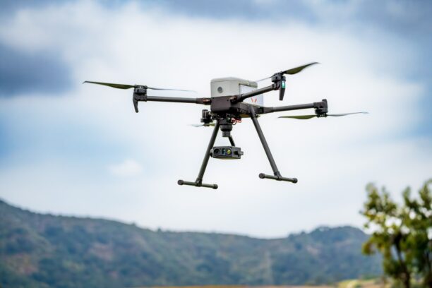
In a significant technological stride, SimActive Inc., a leader in photogrammetry software development, facilitated comprehensive mapping projects in the daunting terrains of the Himalayas through its Correlator3D™ software. This pioneering venture was carried out by Nektor Engineers and Project Consultants (NEPC), an Indian firm known for its innovative approaches to challenging engineering projects.

The Himalayas are not only among the highest mountain ranges in the world but also among the most difficult to map using traditional methods. The area’s rugged terrain, coupled with severe weather conditions, often leads to limited access and complicates aerial surveying efforts. These conditions necessitate innovative technological solutions capable of capturing and processing data efficiently and accurately.

The Himalayas unique and unpredictable climate drastically narrow the window for data acquisition. The NEPC team leveraged multiple drones to collect overlapping images under these tough conditions. Correlator3D™ proved essential in handling the discrepancies in overlap and altitude among the collected data, ensuring the delivery of high-quality mapping outputs.

Krishn Pethani, Chief Technical Officer at NEPC, emphasized the software’s critical role: “When you’re mapping at very high altitudes in the Himalayas, there is not a lot of opportunity to go back and re-fly. It must be done right the first time to ensure the mapping products required are created,” he stated. “We have found Correlator3D to be the best for larger projects in difficult terrains with large variations in overlap.”

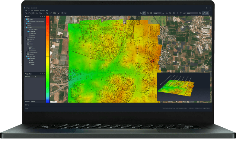
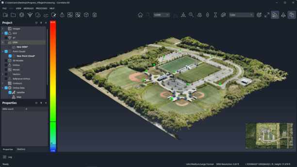
SimActive’s Correlator3D™ software is a patented end-to-end photogrammetry solution designed for the generation of high-quality geospatial data from satellite and aerial imagery, including data collected via drones. The software supports various outputs such as aerial triangulation (AT), dense digital surface models (DSM), digital terrain models (DTM), point clouds, orthomosaics, 3D models, and vectorized 3D features. Utilizing GPU technology and multi-core CPUs, Correlator3D™ facilitates unmatched processing speeds, enabling the rapid production of large datasets. For more information, please visit SimActive.

This collaboration between SimActive and NEPC not only highlights the advancements in remote sensing and photogrammetry technologies but also sets a benchmark for future projects in similarly challenging environments around the world.

Read more:

  • SimActive Enhances Correlator3D with Multi-Camera System Compatibility
  • SimActive Photogrammetry Software: Enabling Users to Meet Accuracy Standards for Over 20 Years
  • Enhancing Photogrammetry Accuracy with Advanced GCPs Integration by SimActive and CompassData

 

Miriam McNabb

Miriam McNabb is the Editor-in-Chief of DRONELIFE and CEO of JobForDrones, a professional drone services marketplace, and a fascinated observer of the emerging drone industry and the regulatory environment for drones. Miriam has penned over 3,000 articles focused on the commercial drone space and is an international speaker and recognized figure in the industry.  Miriam has a degree from the University of Chicago and over 20 years of experience in high tech sales and marketing for new technologies.
For drone industry consulting or writing, Email Miriam.

TWITTER:@spaldingbarker

Subscribe to DroneLife here.
Filed Under: Drone News, Drone News Feeds, Featured - Surveying, News Tagged With: advanced mapping solutions, aerial imagery analysis, Correlator3D features, drone mapping technology, geospatial data Himalayas, Himalayas mapping, NEPC engineering, photogrammetry software, SimActive Correlator3D, terrain mapping

Reader Interactions

Trackbacks

  1. Himalayas Mapping SimActive and NEPC – drone-app.com says:
    May 14, 2024 at 1:34 am

    […] Supply hyperlink […]

    Reply
  2. Advanced Mapping Techniques Reach New Heights in the Himalayas – Independent Drone Exchange says:
    May 13, 2024 at 3:29 pm

    […] post Advanced Mapping Techniques Reach New Heights in the Himalayas appeared first on […]

    Reply

Leave a Reply Cancel reply

Your email address will not be published. Required fields are marked *

Primary Sidebar

LATEST

FAA Releases Draft Design Standards for Vertiports and Vertical Flight Facilities

Updated guidance addresses landing areas, charging infrastructure, and airport integration as advanced air mobility moves toward commercial operations. The Federal…

Continue Reading FAA Releases Draft Design Standards for Vertiports and Vertical Flight Facilities

Amazon Drone Delivery Plan Faces State Review as Massachusetts Residents Organize

MassDOT says Amazon needs state approval for its Westborough facility, while a grassroots organization pushes for greater community involvement in…

Continue Reading Amazon Drone Delivery Plan Faces State Review as Massachusetts Residents Organize

University of Cincinnati Engineers Use Sound to Detect Drone Damage for NASA

Researchers recorded the sounds drones make with chipped or cracked propellers and failing motors. Their aim is to let a…

Continue Reading University of Cincinnati Engineers Use Sound to Detect Drone Damage for NASA

SkyeBrowse Adds New Timelines Tools For Drone Surveys

The release lets drone teams compare up to 10 surveys of a site over time, measure earthwork against design, check…

Continue Reading SkyeBrowse Adds New Timelines Tools For Drone Surveys

Wing and Walmart Launch Drone Delivery in Charlotte

Walmart customers across the Charlotte metro can now order drone delivery from Wing. The launch is part of an expansion…

Continue Reading Wing and Walmart Launch Drone Delivery in Charlotte

Evolver DFR Launches Integrated Drone as First Responder Program

New offering combines Parrot aircraft, autonomous docking, and SkyfireAI software with training, regulatory support, and a multi-year purchasing model. Evolver…

Continue Reading Evolver DFR Launches Integrated Drone as First Responder Program

Vector Expands Defense Drone Portfolio with SOCOM Selection and Blue List Designation

Recent developments highlight the company’s progress in military drone programs, manufacturing, and secure supply chains. Utah-based drone manufacturer Vector has…

Continue Reading Vector Expands Defense Drone Portfolio with SOCOM Selection and Blue List Designation

Elistair Unveils Tethered Solution for the Parrot ANAFI UKR

A new air module connects Parrot’s ANAFI UKR micro-UAV to Elistair’s Safe-T and Ligh-T tether stations, enabling hours of uninterrupted…

Continue Reading Elistair Unveils Tethered Solution for the Parrot ANAFI UKR

Stellios Technologies Emerges From Stealth With High-Power Microwave Systems

The Austin company enters the market with $2 million in signed purchase orders. Its first commercial focus is MW-class high-power…

Continue Reading Stellios Technologies Emerges From Stealth With High-Power Microwave Systems

Team UAV Completes 500 Transformer Drone Inspections for National Grid Electricity Distribution

The drone imagery will support an NGED innovation project testing whether AI and computer vision can identify corrosion and other…

Continue Reading Team UAV Completes 500 Transformer Drone Inspections for National Grid Electricity Distribution

Secondary Sidebar

Footer

SPONSORED

drone cleaning

Do Cleaning Drones Actually Work? 15 Apellix Before-and-After Jobs Show the Results

What Is the Best Commercial Cleaning Drone in 2026? Specs, Prices, and a Head-to-Head Comparison

Inspired Flight Gremsy IF800 VIO F1 drones geo week

What Will It Take to Strengthen U.S. Drone Manufacturing? A Conversation with Inspired Flight’s CEO

Global Mapper Mobile data collection

Collection Ground Control Points with Global Mapper Mobile

Military Drone Mapping Solutions

How SimActive’s Correlator3D™ is Revolutionizing Military Mapping: An Exclusive Interview with CEO Philippe Simard

Photogrammetry Accuracy Standards

SimActive Photogrammetry Software: Enabling Users to Meet Accuracy Standards for Over 20 Years

About Us | Contact Us | Advertise With Us | Write for Us | Privacy Policy | Terms of Service

The Trusted Source for the Business of Drones.

This website uses cookies and third party services. By clicking OK, you are agreeing to our privacy policy. ACCEPT

Manage consent

Privacy Overview

This website uses cookies to improve your experience while you navigate through the website. Out of these, the cookies that are categorized as necessary are stored on your browser as they are essential for the working of basic functionalities of the website. We also use third-party cookies that help us analyze and understand how you use this website. These cookies will be stored in your browser only with your consent. You also have the option to opt-out of these cookies. But opting out of some of these cookies may affect your browsing experience.
Necessary
Always Enabled
Necessary cookies are absolutely essential for the website to function properly. These cookies ensure basic functionalities and security features of the website, anonymously.
CookieDurationDescription
cookielawinfo-checkbox-analytics11 monthsThis cookie is set by GDPR Cookie Consent plugin. The cookie is used to store the user consent for the cookies in the category "Analytics".
cookielawinfo-checkbox-functional11 monthsThe cookie is set by GDPR cookie consent to record the user consent for the cookies in the category "Functional".
cookielawinfo-checkbox-necessary11 monthsThis cookie is set by GDPR Cookie Consent plugin. The cookies is used to store the user consent for the cookies in the category "Necessary".
cookielawinfo-checkbox-others11 monthsThis cookie is set by GDPR Cookie Consent plugin. The cookie is used to store the user consent for the cookies in the category "Other.
cookielawinfo-checkbox-performance11 monthsThis cookie is set by GDPR Cookie Consent plugin. The cookie is used to store the user consent for the cookies in the category "Performance".
viewed_cookie_policy11 monthsThe cookie is set by the GDPR Cookie Consent plugin and is used to store whether or not user has consented to the use of cookies. It does not store any personal data.
Functional
Functional cookies help to perform certain functionalities like sharing the content of the website on social media platforms, collect feedbacks, and other third-party features.
Performance
Performance cookies are used to understand and analyze the key performance indexes of the website which helps in delivering a better user experience for the visitors.
Analytics
Analytical cookies are used to understand how visitors interact with the website. These cookies help provide information on metrics the number of visitors, bounce rate, traffic source, etc.
Advertisement
Advertisement cookies are used to provide visitors with relevant ads and marketing campaigns. These cookies track visitors across websites and collect information to provide customized ads.
Others
Other uncategorized cookies are those that are being analyzed and have not been classified into a category as yet.
SAVE & ACCEPT