
The receive-only application shows nearby drone flight intent and reported positions from UTM services, so public safety and enterprise operators can see other traffic without changing their aircraft or flight software.
ANRA Technologies introduced ANRA VISTA (Visual Interface for Shared Traffic Awareness) on October 14, 2026. The application gives public safety agencies, enterprise drone programs and other authorized operators greater awareness of nearby drone activity. VISTA takes available flight intent and position information from UAS Traffic Management (UTM) services and presents it in a visual interface. As a result, operators can make better-informed decisions both before and during flight.
As drone delivery, Drone as First Responder (DFR) programs, infrastructure inspections and other commercial operations expand, more aircraft from different organizations share the same low-altitude airspace. UTM services coordinate those operations. However, operators may have limited awareness of nearby activity, particularly when other organizations manage those flights.
“As more organizations operate drones in the same airspace, knowing what else may be flying nearby becomes increasingly important,” said Amit Ganjoo, founder and chief executive of ANRA Technologies. “VISTA makes shared airspace information easier to access and understand without requiring operators to change how they fly. It’s a practical way to improve awareness as drone operations continue to scale.”
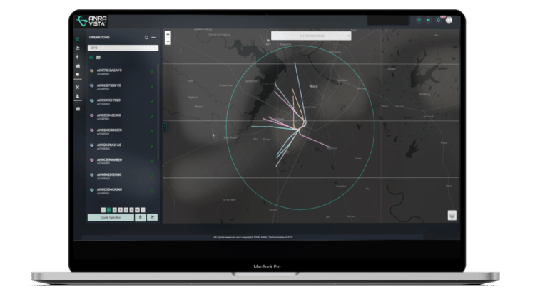
How ANRA VISTA works
VISTA makes shared UTM information available without changes to existing aircraft or flight applications. Notably, the application is receive-only: it does not connect aircraft to UTM or submit flight plans. Instead, it adds a layer of situational awareness that operators can check before takeoff and during missions.
Operators can view available information about drone flight intentions and reported positions around a mission area, in a format they can quickly interpret. They can also check relevant drone activity before launch and keep tracking it as a mission progresses. Because VISTA works alongside existing systems, organizations do not need to replace aircraft, flight applications or operational tools. ANRA intends the application to complement existing operational and safety procedures rather than replace them.
Use cases for public safety and enterprise operators
For public safety agencies, VISTA can show other drone operations near emergency scenes, which helps DFR teams make informed decisions during incident response. Meanwhile, utilities, infrastructure operators and commercial drone programs can use it for added visibility around inspections, maintenance missions and other routine flights.
The application builds on ANRA’s experience running its UTM platform, which the company says currently supports about one drone mission every 15 seconds during daytime operations. In addition, more than 20 organizations, mostly DFR programs, already use ANRA’s visualization capability to track drone activity in their operating areas.
More information is available at ANRA Technologies.
Read More
-
As Drone Delivery Expands, Community Pushback Becomes a Growing Challenge
-
Pentagon Details $450 Million Drone Dominance Competition as Gauntlet 2.5 Moves to November
-
U.S. Drone Manufacturers Expand International Defense Sales as Nepal Orders SPIRIT






Leave a Reply