


New Payload Slashes Time and Boosts Efficiency for Complex Survey Projects
by DRONELIFE Staff Writer Ian J. McNabb
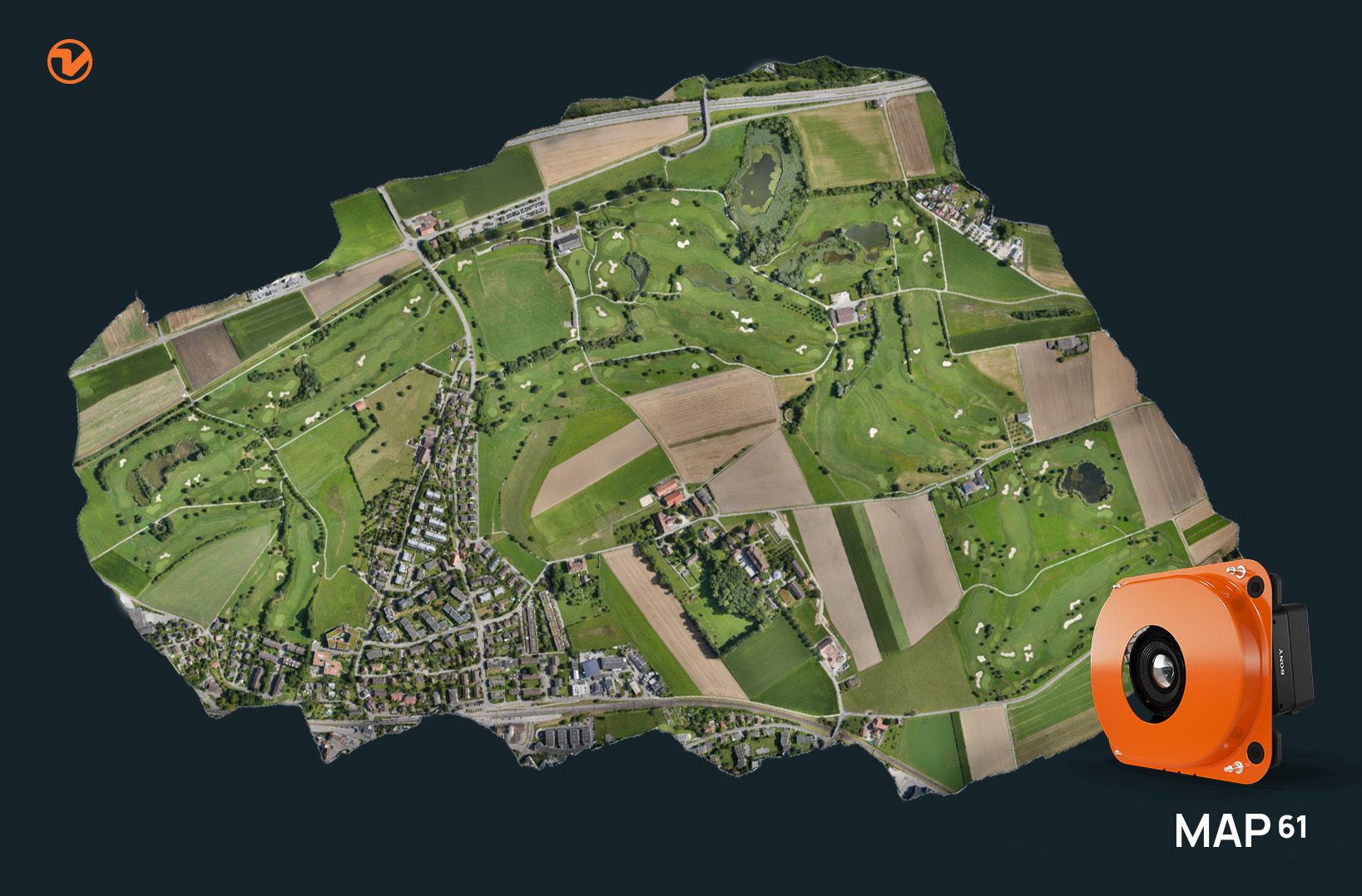
At InterGeo this week, Switzerland-based drone manufacturer Wingtra recently announced their new MAP61 mapping payload, which they describe as “the most efficient mapping sensor on the market”. Able to capture up to 1,140 acres in a single flight, the MAP61 is designed to cover the most land in the fewest images possible, cutting processing times down and compressing complex multi-day survey projects into bite-size chunks that can be handled in a single 24-hour period.

“Imagine reducing your fieldwork time from one hour to just 35 minutes, all while doubling your processing speed,” said Julian Surber, Product Manager at Wingtra.“With MAP61, customers save time capturing and processing whatever their projects demand, whether it’s 2D or 3D optimized data. This level of efficiency doesn’t just save time–it’s a game-changer for anyone looking to increase their productivity and bottom line.”
Via its oblique sensor configuration, the MAP61 is equipped to handle both 2D and 3D mapping and reconstruction, making it a compelling option across a wide range of commercial drone applications, including land management, urban planning, highway mapping, and mining/construction operations. The sensor’s angle removes the need for cross-hatched flight, allowing for users to gather all the data they need with a single flyover.


“Our customers often work in challenging environments like open pit mines, highways, or urban areas, where constraints can limit flight windows.” added Surber. “In these situations, quickly covering large areas is crucial for reducing costs, ensuring the safety of personnel, and delivering timely data to stakeholders. The MAP61 excels in these scenarios, offering speed and efficiency without sacrificing image quality.”
MAP61 is also tightly integrated into Wingtra’s proprietary workflows, including their WingtraCLOUD all-in-one software package that combines flight planning, image capture, image processing, and data export into a single, easy to use interface that is accessible to non-technical staff.
More information on Wingtra’s MAP61 payload, their drones, and their software packages is available here.
Read more:
- Wingtra Introduces Advanced LIDAR Drone Solution for Precision Mapping
- New Payload for Wingtra VTOL Drones: RGB61


Miriam McNabb is the Editor-in-Chief of DRONELIFE and CEO of JobForDrones, a professional drone services marketplace, and a fascinated observer of the emerging drone industry and the regulatory environment for drones. Miriam has penned over 3,000 articles focused on the commercial drone space and is an international speaker and recognized figure in the industry. Miriam has a degree from the University of Chicago and over 20 years of experience in high tech sales and marketing for new technologies.
For drone industry consulting or writing, Email Miriam.
TWITTER:@spaldingbarker
Subscribe to DroneLife here.