At the end of 2022, DroneDeploy and leading ground-based data platform StructionSite merged. Combining the best technology available and merging two strong teams, they are now ready to deliver a product that is greater than the sum of its parts. Today, DroneDeploy announced a new, unified ground and air-based platform.
As they have from their inception in 2013, DroneDeploy based this major development on the overarching goal of streamlining and simplifying workflows. “It’s so awesome to have all of our customers here in one place,” said Winn. “Everything we’ve built is because of you. With you, we’re building the future of reality capture.” For Winn and DroneDeploy, the future of reality capture is:
- Unified: All the data in one place
- Automated: Collected by robot on a schedule
- Intelligent: Providing answers, not just data
With the new platform – allowing customers a seamlessly integrated exterior, ground-based view of their site combined with the aerial data gathered from drones – DroneDeploy is delivering.
Winn said that reality capture enables stakeholders with what migh previously be considered superpowers: they can fly above a jobsite, getting a view of thousands of acres; they can teleport to any jobsite in the world; they can time travel to see what happened 30 days ago; and they can get an X-ray view of what’s behind the walls. Now, all of those powers can be deployed and the benefits realized.
Perhaps most importantly – for the company that has been working for over a decade towards one button processing – is the easy of use that a unified platform offers. “People get app fatigue…3/4 of you use more than 1 reality capture project, 1/4 of you use more than 4. That’s not simple,” said Winn.
With the existing technology and expertise of industry leading StructureSite added to the mature technology of DroneDeploy, the new platform offers “the best of DroneDeploy, the best of Structure Sight…it’s beautiful, and it’s easy to use,” said Winn. Easier to use, and easier to mange: “It’s one platform, one vendor, one security audit, one app.”
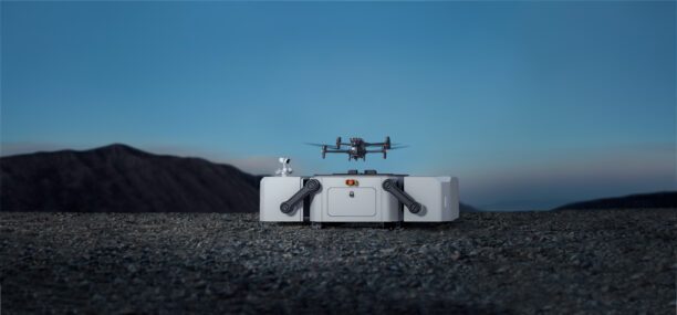
From the beginning, DroneDeploy has been designed as a powerful cloud platform able to take advantage of automated robotic systems. “It was obvious from the beginning that that was the direction the industry was going,” said Winn. Now, as the price point of docked drones has come down dramatically, the commercial potential of full automation can be realized. “We think that by 2027, about half of your data will be collected by autonomous robot…. [Automated data capture] is super simple, it’s secure, and it’s going to be ready to deploy in the next 12 months.” The drone agnostic platform is compatible with DJI dock, Skydio dock and Flytbase in addition to ground robotics including Boston Dynamics’ Spot.
Intelligent: AI-Powered
Automating data capture results in a lot more data gathered. “We’ve created a new set of problems: who is going to look at all this data?” asked Winn. “We need a new superpower.” AI has been part of the DroneDeploy vision from the beginning. “Both of my cofounders did their PhDs in this,” commented Winn. “Your reality platform should know more about your jobsite than any individual – and you should be able to ask it questions.” That’s what DroneDeploy is working towards: in a practical sense, that should result in the automated production of reports that fully answer a question, and tools that work across use cases by leveraging generative AI.
Co-Founder and CTO Nick Pilkington offered a peek at the future. Pilkington demonstrated some of the amazing AI features: over a vast parking area, typing “cars” can generate an immediate count of all of the cars in the lot. A look at a construction site can identify all of the construction vehicles on the site, anticipating what users will need from their data. It’s not just aerial views: “We’re unified. What we do for aerial we do for ground,” Pilkington said. Clicking on one object in the view – like a stack of drywall – will show how many other stacks of drywall exist on the floor. “We’re demonstrating what it means to understand every pixel,” he said. “This is going to power some amazing products that you’ll see in Q4.”
In addition to the other big shifts, DroneDeploy has improved the accuracy of the offering, so that DroneDeploy can be used for high accuracy use cases. “We’re making high accuracy accessible to anyone: not in old ways where you have to have survey knowledge,” said Winn. “We’re making 1 inch accuracy available to everyone.” They’re offering new data products from the same data, no more steps required. The new platform offers a wide variety of new features – responding to customer requests and comments – all designed to make the data capture easier, and the data more useful.
After a decade of development, the newest DroneDeploy platform is again setting industry standards. “We’re super excited about the pace of development we’re seeing now,” said Winn.
Read more:
- DroneDeploy and BNSF on Autonomous Reality Capture: The Difference Between Automated and Autonomous
- Drone Mapping Company DroneDeploy Releases Social Impact Report
- DroneDeploy’s New Products Go Far Beyond Drones
- Latest DroneDeploy Funding Round Adds $50 Million for Expansion
Miriam McNabb is the Editor-in-Chief of DRONELIFE and CEO of JobForDrones, a professional drone services marketplace, and a fascinated observer of the emerging drone industry and the regulatory environment for drones. Miriam has penned over 3,000 articles focused on the commercial drone space and is an international speaker and recognized figure in the industry. Miriam has a degree from the University of Chicago and over 20 years of experience in high tech sales and marketing for new technologies.
For drone industry consulting or writing, Email Miriam.
TWITTER:@spaldingbarker
Subscribe to DroneLife here.
