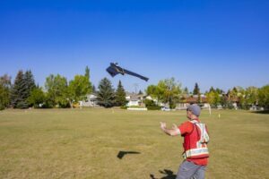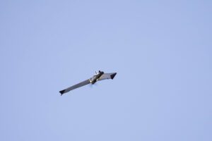
All images, credit to Droto Photography
IN-FLIGHT Data and AirMatrix Achieve Industry First in Canada
by DRONELIFE Staff Writer Ian M. Crosby
In partnership with remote traffic management software leader AirMatrix, advanced drone operator IN-FLIGHT Data conducted one of the world’s first urban signals mapping operations following the previous year’s revolutionary UTM project. The successful “SAIL 4” flight was nearly 1,000 feet above ground, beyond the line of sight of the pilot, and over urban neighborhood populations. “SAIL” refers to the regulator’s combined complexity of a drone mission, from a range of 1 (low) to 6 (high). This is the first ever project of this level and scale to be completed.
 Ever since last year’s Phase 1 of the project, IN-FLIGHT Data and AirMatrix have been building towards a significantly larger advanced RF survey in Calgary in partnership with The City’s Smart City Living Labs Program. The City intends to offer access to its assets for companies, researchers and individuals to test ideas and products in a real-life environment, assisting entrepreneurs in realizing their goals and promoting investment in the local economy.
The project’s Phase 2 flew for 660 km inside Calgary, with a population of roughly 1.4 million, under approved SFOC. For the majority of the high aerial survey, the aircraft was more than 2 km away from the pilot. A highly-trained air crew utilized advanced and certified drones, along with cutting-edge aerial surveillance technologies, in order to scale-up the measurement and assessment of the communications network fabric above Calgary, including geolocation, cellular, radio and more.
 A full understanding of urban radio network performance is necessary to allow for future advancements in aviation. Recently in the USA, for example, the FAA announced the approval of flying taxis by 2028. This project promotes the development of these innovations in transportation and mobility, such as aircraft like Uber, Archer or Joby.
The involvement of telecommunications companies, governments, regulators, airspace navigation service providers, and industry are all necessary for a total understanding of how high-performance drones will safely navigate and communicate above populated areas. Completing the 3D mapping of the urban network fabric allows for an understanding of how future aircraft and infrastructure can leverage these new high-performance networks to provide cities with future technological advancements.
Read more:
- 3D Drone Mapping: Inside Parrot Impossible Mission Over Positano [VIDEO]
- In Calgary, a SAIL 4 BVLOS Urban Drone Operation Measures Aerial Network Performance
- A Model of Korea: the Ambitious Project to Make a Digital Twin of a Country
- These Companies Use Military and Aviation Radar to Scale Urban Drone Operations in Calgary
Ian attended Dominican University of California, where he received a BA in English in 2019. With a lifelong passion for writing and storytelling and a keen interest in technology, he is now contributing to DroneLife as a staff writer.

Miriam McNabb is the Editor-in-Chief of DRONELIFE and CEO of JobForDrones, a professional drone services marketplace, and a fascinated observer of the emerging drone industry and the regulatory environment for drones. Miriam has penned over 3,000 articles focused on the commercial drone space and is an international speaker and recognized figure in the industry. Miriam has a degree from the University of Chicago and over 20 years of experience in high tech sales and marketing for new technologies.
For drone industry consulting or writing, Email Miriam.
TWITTER:@spaldingbarker
Subscribe to DroneLife here.


[…] AirMatrix, IN-FLIGHT Complete SAIL 4, BVLOS Drone Ops Over Urban Areas: Pushing the Boundaries of Co… […]