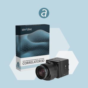
SimActive Inc.’s Correlator 3D photogrammetry software is designed for large mapping projects. Phase One, a pioneer of digital imaging sensors and airborne systems, are a leading tool for data capture. Now, SimActive and Phase One have partnered on Correlator3D Version 9.2 to offer productivity enhancements that include the support of Phase One’s Intelligent Image Quality (IIQ) format.
“Imagery can now be processed in Phase One’s IIQ format, without going through an intermediate format. Working directly with the compressed files allows for much easier data management on large projects,” says a SimActive press release.
“Allowing our users to directly process imagery in our native IIQ format enables a faster and more seamless workflow.” Said Anthony Garetto, Chief Product Officer at Phase One. “We are thrilled that SimActive’s development team was able to make this integration happen so quickly.”
“To facilitate the workflow of an overwhelming number of Phase One customers, our development team was able to rapidly implement this key differentiator into our software”, said Louis Simard, Chief Technology Officer at SimActive. “Phase One has become a leader in quality mapping sensors, and we are extremely happy to be a part of this collaboration.”
About Phase One
Phase One – a pioneer of digital imaging sensors and airborne systems for the Geo market and the largest provider of aerial cameras based on a long tradition for outstanding image quality and reliable sensors. Founded in 1993, Phase One is a pioneer of digital photography. Phase One has developed core imaging technologies and a range of digital cameras and imaging modules, providing the world’s highest image quality in terms of resolution, dynamic range, color fidelity and geometric accuracy. As such, Phase One has grown to become the leading provider of high-end imaging technology across many demanding business segments, such as aerial mapping, industrial inspection and cultural heritage digitization, as well as serving the world’s most demanding photographers. For more Information, visit www.phaseone.com.
About SimActive
SimActive is the developer of Correlator3D™ software, a patented end-to-end photogrammetry solution for the generation of high-quality geospatial data from satellite and aerial imagery, including drones. Correlator3D™ performs aerial triangulation (AT) and produces dense digital surface models (DSM), digital terrain models (DTM), point clouds, orthomosaics, 3D models and vectorized 3D features. Powered by GPU technology and multi-core CPUs, Correlator3D™ ensures matchless processing speed to support rapid production of large datasets. SimActive has been selling Correlator3D™ to leading mapping firms and government organizations around the world, offering cutting-edge photogrammetry software backed by exceptional customer support. For more information, visit www.simactive.com.
Read more about SimActive:
- Are Drones Always the Best Tool for the Job? Beacon Aviation Reduces Mapping Costs with SimActive
- Drone Mapping in Construction: SimActives Correlator 3D in the Field in Texas
- Creating Colorized Point Clouds, Reflective Calibration, and More: Diving into SimActives New Features
- Mapping and LiDAR: SimActive Integrated with LiDAR Solution for Drones
- The Right Tools for Oil and Gas Exploration: SimActive and Dawson Geophysical
Miriam McNabb is the Editor-in-Chief of DRONELIFE and CEO of JobForDrones, a professional drone services marketplace, and a fascinated observer of the emerging drone industry and the regulatory environment for drones. Miriam has penned over 3,000 articles focused on the commercial drone space and is an international speaker and recognized figure in the industry. Miriam has a degree from the University of Chicago and over 20 years of experience in high tech sales and marketing for new technologies.
For drone industry consulting or writing, Email Miriam.
TWITTER:@spaldingbarker
Subscribe to DroneLife here.