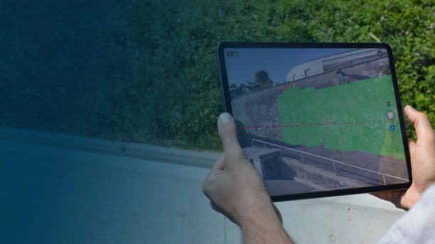
Drone trade shows around the world are opening up, and companies are showcasing their newest techologies. Photogrammetry company Pix4D started in 2011 to harness the power of aerial data. Now, the company will be at InterGeo to showcase their new Pix4D terrestrial data collection hardware and software, which provide customers with a ground-based option to effectively map an entire space.
Pix4D will be giving live demos of its terrestrial data collection hardware and software solution, PIX4Dcatch and the viDoc RTK rover for iPhone Pro and iPad Pro. These new products demonstrate an interesting trend, as drone mapping platforms move beyond a strict focus on aerial data to include ground data capture: a feature that allows construction and other industrial customers to use one product to map all aspects of a space.
In addition to the Pix4D terrestrial data capture solutions, Pix4D will showcase their newest updates for their photogrammetry platform PIX4Dmatic and PIX4Dsurvey, which the company says have benefited from major investments in R&D over the last 10 years. “Now they can process LiDAR and photogrammetry datasets in the same project, getting the best of both forms of data collection. In addition, PIX4Dsurvey now includes volume measurements in its workflow, adding to its utility in working with vectorizing and generating a TIN of projects to prepare them for CAD,” says a Pix4D press release. “Both of these updates are being launched with a novel perpetual license scheme along with the existing subscriptions, as well as pricing adjustments and promotional discounts for the rest of 2021 to celebrate their impact.”
“We are excited to attend Intergeo and see other geospatial professionals and specialists as we share our experiences and ideas,” says Pix4D CEO and co-founder Christoph Strecha. “We’ll also be providing live demos of the viDoc RTK rover to show users how they can get professional results with Pix4D software and a consumer mobile device – an iPhone or iPad. It’s exciting to be able to interact in person in a safe environment.”
Pix4D’s 10 year anniversary is a milestone in the young drone industry. “…the Intergeo event is a great opportunity for Pix4D to highlight what a decade of experience brings, and what functionalities the latest photogrammetry software can achieve,” says the company. Pix4D will also host a user conference in October.
Miriam McNabb is the Editor-in-Chief of DRONELIFE and CEO of JobForDrones, a professional drone services marketplace, and a fascinated observer of the emerging drone industry and the regulatory environment for drones. Miriam has penned over 3,000 articles focused on the commercial drone space and is an international speaker and recognized figure in the industry. Miriam has a degree from the University of Chicago and over 20 years of experience in high tech sales and marketing for new technologies.
For drone industry consulting or writing, Email Miriam.
TWITTER:@spaldingbarker
Subscribe to DroneLife here.
