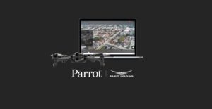
Advanced geospatial augmented reality overlays now compatible with ANAFI platform drones
Parrot, the leading European drone group, announced today its partnership with Rapid Imaging – a technology provider delivering geospatial augmented reality (AR) and situational awareness solutions to government and enterprise users.
The new partnership “pairs Parrot ANAFI USA, ANAFI platform drones, and the FreeFly SDK with Rapid Imaging’s SmartCam3D® SDK, the industry-leading geospatial Augmented Reality and situational awareness platform for Unmanned Aircraft Systems,” says a company press release.
Augmented reality functionality helps provide drone operators with additional situational awareness. “SmartCam3D® overlays valuable geospatial data such as Street Vectors, Road Names, Points of Interest, Polygons, and other pertinent map entities onto real-time, full-motion-video (FMV) provided by the ANAFI USA’s powerful 4K HDR video, 32x zoom, and live video streaming capabilities – providing mission personnel with advanced situational awareness as they perform critical drone operations,” says the release. “SmartCam3D® also allows end-users to interact with live drone video in the same ways they would a map display, such as dropping a pin to mark a location or geocoding a selection from the real-time video stream. These powerful situational awareness capabilities present opportunities across a variety of mission-sets ranging from Airborne Law Enforcement, Insurance, and Industrial Inspections, to natural disaster response, Real Estate, and search and rescue operations.”
The Parrot and Rapid Imaging partnership provides ANAFI users with even greater functionality.
“Leveraging Parrot ANAFI USA’s precise GPS coordinates and advanced flight features, SmartCam3D® provides first responders and military personnel with up-to-date geospatial AR overlays on live video, combining the benefits of both a 2D map display and a Full-Motion-Video display into a single operating picture.” said Jerome Bouvard, Parrot Director of Strategic Partnerships. “This new partnership will provide easy-to-comprehend data to better assist first responders into making quick and accurate decisions during high-stress missions.”
All data captured through SmartCam3D® during sensitive missions is secure, as Parrot drone users must opt-in to share flight data with Parrot’s secure to store footage. Parrot ANAFI USA also features Secure Digital (SD) card encryption, which ensures complete protection of photos and videos if the drone or the SD card is lost.
“The Parrot ANAFI USA has been a great platform to work with – as a developer with a long history of providing geospatial situational awareness technologies to military end-users, platform metadata reported from the UAV is critical to mission success,” said David Geisler, CEO of Rapid Imaging. “The team at Parrot does it right, ensuring high-quality, synchronous metadata from the ANAFI and ensuring accurate geospatial information and overlays for end-users.”
The SmartCam3D® SDK is available for Android, iOS, Linux, and Windows systems for use with ANAFI and ANAFI USA platform drones.

Miriam McNabb is the Editor-in-Chief of DRONELIFE and CEO of JobForDrones, a professional drone services marketplace, and a fascinated observer of the emerging drone industry and the regulatory environment for drones. Miriam has penned over 3,000 articles focused on the commercial drone space and is an international speaker and recognized figure in the industry. Miriam has a degree from the University of Chicago and over 20 years of experience in high tech sales and marketing for new technologies.
For drone industry consulting or writing, Email Miriam.
TWITTER:@spaldingbarker
Subscribe to DroneLife here.