• Skip to main content
  • Skip to secondary menu
  • Skip to primary sidebar
  • Skip to secondary sidebar
  • Skip to footer
  • DroneRacingLife
  • DroneFlyers
  • Newsletter
DroneLife

DRONELIFE

Stay up to date on all the latest Drone News

  • News
  • Products
  • Industries
    • Agriculture
    • Construction
    • Delivery
    • Dual Use
    • Inspection
    • Public Safety
    • Surveying
  • Enthusiasts
  • Regulations
  • Business
  • Video
  • Podcasts

North Carolina Takes Aim at Drones – But Hits Free Speech

April 10, 2021 by Miriam McNabb 11 Comments

DRONELIFE reported earlier on a lawsuit in North Carolina challenging the notion that drone mapping is surveying without a license.  Here, members of the organization representing commercial drone operator Michael Jones lay out their case to protect his rights to sell aerial images.

The following is a guest post by Sam Gedge and Daryl James of the Institute for Justice in Arlington, Va.  DRONELIFE neither accepts nor makes payments for guest posts.

Nobody tries to shut down Google when the tech giant takes aerial photographs and stitches them together seamlessly in Maps. But North Carolina regulators pounced on Goldsboro drone operator Michael Jones when he did something similar for his clients.

The North Carolina Board of Examiners for Engineers and Surveyors sent Jones a cease-and-desist letter in summer 2019, accusing him of violating state laws against the unlicensed practice of land surveying. The ancient profession—as old as property taxes—deals with the measurement and recording of real estate boundaries for legal purposes.

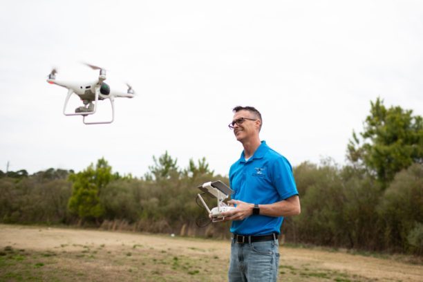
The allegations stunned Jones, who never did anything close to surveying. He just mounted cameras and other equipment onto drones, and used the technology to capture high-resolution images packed with information for his clients.

Sometimes he created multiple frames that fit together like a puzzle or grid, but he never purported to establish legal plot boundaries. His work was purely informational. “I never submitted anything official,” Jones says.

Google provides similar services when it labels landmarks and draws lines on interactive maps. So do Apple, MapQuest, Bing and Garmin. None of these activities establishes or changes property lines for legal purposes. Otherwise, North Carolina would be busy sending nasty letters to corporate headquarters all over the world.

If the state tried to silence Silicon Valley and other tech hubs, it would get a quick lesson in the First Amendment. Gathering, formatting and sharing information is speech—whether people use old typewriters or cutting-edge quadcopters. The Constitution protects the process regardless of the technology involved, even when someone sells the final product for money.

The U.S. Supreme Court recently confirmed the principle. “Speech is not unprotected merely because it is uttered by professionals,” and the government cannot claim “unfettered power to reduce a group’s First Amendment rights by simply imposing a licensing requirement,” the Court declared in 2018.

North Carolina board members missed the memo. Since 2018 they have issued around a half-dozen cease-and-desist letters to drone operators like Jones. Elsewhere, surveyors in California and Oregon have launched their own efforts to keep drones out of the sky.

Rather than stay grounded, Jones has partnered with the nonprofit Institute for Justice and sued the government. His lawsuit, filed March 22 in federal court, asserts his right to collect and share information—just like anyone else with a camera.

Some photographers shoot weddings. Others shoot nature, sports, fashion and news. Jones shoots rooftops using a remote camera 400 feet in the air. Artistic merit is irrelevant. The First Amendment guarantees the right to use words and graphics without a license.

Unfortunately, surveying boards sometimes care more about protecting industry insiders from competition than protecting civil rights. When they look up and see drones, they panic. Customers, who sometimes hire surveyors to draw maps and measure distances, now have alternatives that were unavailable just 10 or 20 years ago.

Drones not only can do many jobs faster than teams on the ground, but also cheaper. A single photographer can scan an entire construction site, so builders can monitor the progress of their work. The possibilities for other applications are endless.

Some people would call this progress. But some licensed surveyors see it as an invasion on their turf. In fact, one member of North Carolina’s surveying board mused publicly whether the agency’s recent spike in investigations represents a response to new, innovative technology services.

Essentially, the industry wants to criminalize this innovation rather than adapt. The Luddites tried something similar in the 1800s, when they destroyed textile machinery as a protest against change. More recently, taxi drivers have tried to block ride-hailing services like Uber and Lyft. And real estate agents have tried to shut down property listing sites like Zillow.

Tension is inevitable when new technology collides with old, but the Constitution remains constant. North Carolina’s surveying board should understand this. They mark boundaries for a living, but they cross a line when they try to silence speech.

Sam Gedge is an attorney and Daryl James is a writer at the Institute for Justice in Arlington, Va., which is representing Michael Jones and his business in their lawsuit against the North Carolina surveying board.

Miriam McNabb

Miriam McNabb is the Editor-in-Chief of DRONELIFE and CEO of JobForDrones, a professional drone services marketplace, and a fascinated observer of the emerging drone industry and the regulatory environment for drones. Miriam has penned over 3,000 articles focused on the commercial drone space and is an international speaker and recognized figure in the industry.  Miriam has a degree from the University of Chicago and over 20 years of experience in high tech sales and marketing for new technologies.
For drone industry consulting or writing, Email Miriam.

TWITTER:@spaldingbarker

Subscribe to DroneLife here.

Filed Under: Drone News Feeds, Featured, News Tagged With: commercial drone operators, Drone Photography, drones for surveying, North Carolina Lawsuit

Reader Interactions

Trackbacks

  1. North Carolina Takes Aim at Drones – But Hits Free Speech - Eledonk Electronics says:
    April 11, 2021 at 2:07 am

    […] post North Carolina Takes Aim at Drones – But Hits Free Speech appeared first on […]

    Reply
  2. North Carolina Takes Aim at Drones – But Hits Free Speech - On Sale Drones says:
    April 11, 2021 at 12:20 am

    […] Source […]

    Reply
  3. North Carolina Takes Aim at Drones – But Hits Free Speech - DronesOnline.site says:
    April 10, 2021 at 11:04 pm

    […] post North Carolina Takes Aim at Drones – But Hits Free Speech appeared first on […]

    Reply
  4. North Carolina Takes Aim at Drones – But Hits Free Speech – Top Drones & reviews says:
    April 10, 2021 at 11:04 pm

    […] post North Carolina Takes Aim at Drones – But Hits Free Speech appeared first on […]

    Reply
  5. North Carolina Takes Aim at Drones - Go Drones Blog says:
    April 10, 2021 at 5:11 pm

    […] Institute of Justice on the first amendment case for allowing commercial drone operators to sell aerial images without a surveying license. Source […]

    Reply
  6. North Carolina Takes Aim at Drones – But Hits Free Speech – DronePilots.News says:
    April 10, 2021 at 7:24 am

    […] Source […]

    Reply
  7. North Carolina Takes Aim at Drones – But Hits Free Speech | Drone Magazine says:
    April 10, 2021 at 6:55 am

    […] Source […]

    Reply
  8. North Carolina Takes Aim at Drones – But Hits Free Speech – Drone Observer says:
    April 10, 2021 at 6:24 am

    […] Source link […]

    Reply
  9. North Carolina Takes Aim at Drones – But Hits Free Speech – DronePilots.News says:
    April 10, 2021 at 6:24 am

    […] post North Carolina Takes Aim at Drones – But Hits Free Speech appeared first on […]

    Reply
  10. North Carolina Takes Aim at Drones – But Hits Free Speech – Game of Drones says:
    April 10, 2021 at 6:21 am

    […] Article Source […]

    Reply
  11. North Carolina Takes Aim at Drones – But Hits Free Speech – Best Drones Online says:
    April 10, 2021 at 6:08 am

    […] post North Carolina Takes Aim at Drones – But Hits Free Speech appeared first on […]

    Reply

Leave a Reply Cancel reply

Your email address will not be published. Required fields are marked *

Primary Sidebar

LATEST

Can Drones Replace High-Speed Police Pursuits? BRINC’s Guardian Points to a New Model

At the recent Motorola Solutions [NYSE: MSI], BRINC CEO Blake Resnick outlined a vision that challenges one of policing’s most…

Continue Reading Can Drones Replace High-Speed Police Pursuits? BRINC’s Guardian Points to a New Model

Can America Build a Fully Domestic Drone? Lithium Discovery Moves the Needle

New USGS findings highlight potential for domestic lithium supply, but key gaps remain in the battery chain A new study…

Continue Reading Can America Build a Fully Domestic Drone? Lithium Discovery Moves the Needle

Public Safety Drone Review: May 5, 2026 with BRINC CEO Blake Resnick

Join the Live Discussion on May 5 Register here for the May Public Safety Drone Review. The next Public Safety…

Continue Reading Public Safety Drone Review: May 5, 2026 with BRINC CEO Blake Resnick

Lawmakers Urge Expanded National Guard Role for Drone Security at 2026 FIFA World Cup

Letter calls for unified federal approach to counter-UAS operations across U.S. host cities U.S. lawmakers are calling on the federal…

Continue Reading Lawmakers Urge Expanded National Guard Role for Drone Security at 2026 FIFA World Cup

Skydio Raises $110M Series F, Signals Strong Revenue and U.S. Manufacturing Push

CEO Adam Bry highlights reduced capital needs as company expands production and commits billions to domestic manufacturing Skydio has raised…

Continue Reading Skydio Raises $110M Series F, Signals Strong Revenue and U.S. Manufacturing Push

Teledyne FLIR Defense Expands Payload Program with Emesent Hovermap for GPS-Denied Operations

New integration brings LiDAR mapping and radiation detection together across air and ground platforms Teledyne FLIR Defense has expanded its…

Continue Reading Teledyne FLIR Defense Expands Payload Program with Emesent Hovermap for GPS-Denied Operations

ideaForge Signs MoU with Japan’s DMP to Develop AI Drones

India’s largest UAV maker partners with Tokyo-based Digital Media Professionals to integrate edge AI silicon and enter the Japanese defense…

Continue Reading ideaForge Signs MoU with Japan’s DMP to Develop AI Drones

WISPR Systems’ SkyScout 2+ Earns Blue UAS Cleared List Approval

WISPR Systems’ SkyScout 2+ receives Blue UAS Cleared List designation from DCMA, validating the platform for federal, public safety, and…

Continue Reading WISPR Systems’ SkyScout 2+ Earns Blue UAS Cleared List Approval

SkyfireAI Raises $11M to Advance Autonomous Multi-Drone Operations for Public Safety

New platform aims to reduce operator workload while enabling coordinated drone response at scale SkyfireAI has announced an $11 million…

Continue Reading SkyfireAI Raises $11M to Advance Autonomous Multi-Drone Operations for Public Safety

What Starlink Actually Changes for Police Drones: A Look at BRINC’s Guardian

BRINC Guardian with Starlink: A New Standard for Drone as First Responder?Satellite connectivity, redundancy, and real-world range could reshape police…

Continue Reading What Starlink Actually Changes for Police Drones: A Look at BRINC’s Guardian

Secondary Sidebar

Footer

SPONSORED

Inspired Flight Gremsy IF800 VIO F1 drones geo week

What Will It Take to Strengthen U.S. Drone Manufacturing? A Conversation with Inspired Flight’s CEO

Global Mapper Mobile data collection

Collection Ground Control Points with Global Mapper Mobile

Military Drone Mapping Solutions

How SimActive’s Correlator3D™ is Revolutionizing Military Mapping: An Exclusive Interview with CEO Philippe Simard

Photogrammetry Accuracy Standards

SimActive Photogrammetry Software: Enabling Users to Meet Accuracy Standards for Over 20 Years

NACT Engineering Parrot ANAFI tether indoor shot

Smart Tether for Parrot ANAFI USA from NACT Engineering

Blue Marble, features global mapper, features Blue Marble

Check Out These New Features in Global Mapper v25 from Blue Marble

About Us | Contact Us | Advertise With Us | Write for Us | Privacy Policy | Terms of Service

The Trusted Source for the Business of Drones.

This website uses cookies and third party services. By clicking OK, you are agreeing to our privacy policy. ACCEPT

Manage consent

Privacy Overview

This website uses cookies to improve your experience while you navigate through the website. Out of these, the cookies that are categorized as necessary are stored on your browser as they are essential for the working of basic functionalities of the website. We also use third-party cookies that help us analyze and understand how you use this website. These cookies will be stored in your browser only with your consent. You also have the option to opt-out of these cookies. But opting out of some of these cookies may affect your browsing experience.
Necessary
Always Enabled
Necessary cookies are absolutely essential for the website to function properly. These cookies ensure basic functionalities and security features of the website, anonymously.
CookieDurationDescription
cookielawinfo-checkbox-analytics11 monthsThis cookie is set by GDPR Cookie Consent plugin. The cookie is used to store the user consent for the cookies in the category "Analytics".
cookielawinfo-checkbox-functional11 monthsThe cookie is set by GDPR cookie consent to record the user consent for the cookies in the category "Functional".
cookielawinfo-checkbox-necessary11 monthsThis cookie is set by GDPR Cookie Consent plugin. The cookies is used to store the user consent for the cookies in the category "Necessary".
cookielawinfo-checkbox-others11 monthsThis cookie is set by GDPR Cookie Consent plugin. The cookie is used to store the user consent for the cookies in the category "Other.
cookielawinfo-checkbox-performance11 monthsThis cookie is set by GDPR Cookie Consent plugin. The cookie is used to store the user consent for the cookies in the category "Performance".
viewed_cookie_policy11 monthsThe cookie is set by the GDPR Cookie Consent plugin and is used to store whether or not user has consented to the use of cookies. It does not store any personal data.
Functional
Functional cookies help to perform certain functionalities like sharing the content of the website on social media platforms, collect feedbacks, and other third-party features.
Performance
Performance cookies are used to understand and analyze the key performance indexes of the website which helps in delivering a better user experience for the visitors.
Analytics
Analytical cookies are used to understand how visitors interact with the website. These cookies help provide information on metrics the number of visitors, bounce rate, traffic source, etc.
Advertisement
Advertisement cookies are used to provide visitors with relevant ads and marketing campaigns. These cookies track visitors across websites and collect information to provide customized ads.
Others
Other uncategorized cookies are those that are being analyzed and have not been classified into a category as yet.
SAVE & ACCEPT