• Skip to main content
  • Skip to secondary menu
  • Skip to primary sidebar
  • Skip to secondary sidebar
  • Skip to footer
  • DroneRacingLife
  • DroneFlyers
  • Newsletter
DroneLife

DRONELIFE

Stay up to date on all the latest Drone News

  • News
  • Products
  • Industries
    • Agriculture
    • Construction
    • Delivery
    • Dual Use
    • Inspection
    • Public Safety
    • Surveying
  • Enthusiasts
  • Regulations
  • Business
  • Video
  • Podcasts

LiDAR Surveys by Drone: Increasing Flight Endurance for a Big Impact on Productivity

March 11, 2021 by Miriam McNabb 22 Comments

LiDAR surveys
created by DJI camera

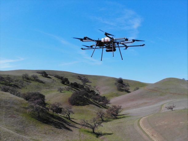
Used for creating precise 3D models of terrain for mapping and more, LiDAR surveys are an important commercial application for the drone industry – but battery limitations and the associated short flight times remain a problem.  Now, California-based Skyfront is working with European UAV LiDAR solution provider Routescene to explore the impact of increasing flight endurance, using Skyfront’s Perimeter 8 gasoline-electric hybrid multicopter.

Drone battery life is a problem for all commercial drone operations: but when combined with the weight of LiDAR sensors, flight endurance can be severely affected. “Typically a drone utilising lithium polymer batteries, such as a DJI M600, and carrying a 3.3kg payload (for example a Routescene UAV LiDAR system) would operate with a flight time of around 15-20 minutes,” says a press release. “Landing, replacing the batteries and take-off between each flight can take longer than the flight itself, directly influencing the size of the survey area that can be flown each day.”

The impact of reducing downtime in LiDAR surveys

For larger LiDAR survey sites that might require more than one take-off and landing site, the limited flight time can lead to significant downtime – which costs signficant money.  Teams from Skyfront and Routescene set out to demonstrate that increasing flight time by using a hybrid fueled drone could signficantly impact data collection productivity.

The results were an impressive 3 hour flight time for the Skyfront Perimeter 8 carrying a Routescene LiDAR payload: reducing downtime so significantly that a typical 2-day project could be completed in one day.  “The Skyfront Perimeter 8 is an eight rotor hybrid UAV designed for carrying heavier payloads such as LiDAR. The Perimeter 8 has both rotor and complete engine redundancy for safety,” explains the release.

Gert Riemersma, Founder and CTO of Routescene, commented, “Through this testing the team found the greatest benefit gained was regarding efficiency. Due to the longer flight times, only one take-off and landing site was required, removing the need to travel between sites to repeatedly set up. In addition, a considerable amount of time was saved simply by eradicating turn-around times to replace batteries. We estimated that by achieving 3 hours of flight time at 5m/s you can readily cover 54 survey line kilometres, or just over 500 acres. This is equivalent to roughly 10 x M600 flights, which would normally take two days to complete. An impressive result, reducing two days of surveying into less than one day, simply by eliminating downtime.”

LiDAR surveysThe Routescene UAV LiDAR system has a solid state disc onboard capable of storing over 13 hours worth of data, “more than enough for a full day in the field,” explains the team. “The quality of the data being collected is monitored in real-time during the entire drone survey using Routescene’s QA Monitor, a web based app, to make sure you leave the survey site with the data you need. At the end of the survey the data can be downloaded and checked in the field using Routescene’s LidarViewer Pro data processing software.”

Gert added, “Routescene has a strong ethos of quality assurance and quality control (QA/QC). Implementing rigorous QA/QC improves data quality and efficiencies. QA Monitor gives you confidence in the data you are collecting while you are collecting it. The last thing you want after completing a long survey flight is to realise there was an issue and the team has to mobilise to fly the area again. It prevents time being wasted, you can identify an issue immediately, remedy it there and then in the field, bringing further efficiencies to the increased gains brought by longer flight times.”

Longer flight times don’t only increase productivity – they have a positive impact on safety too. “The riskiest parts of a UAV flight are the take-offs and landings, when the drone is under manual control and hence when accidents are most likely to occur. Reducing the number of take-offs and landings obviously directly reduces the probability of an accident,” says Skyfront.

Brian Maxwell, VP of Business Development at Skyfront, confirmed, “Our flight time of 3 hours was particularly impressive and allowed a huge volume of 3D data to be collected efficiently. We found that we could considerably improve the resilience, efficiency and safety of UAV LiDAR surveys by increasing the flight time.”

Christian Andresen from the University of Wisconsin added, “In 2017 and 2018 we surveyed areas of the Arctic as part of the NGEE Arctic project researching changes to permafrost and ecosystem structure. What we observed over the 2 years whilst working there was how much drone technology improved and the positive impact that had on flight times. The Arctic location was exceptionally remote and all incremental improvements make a huge difference to our efficiency and reduce time spent in the field. A drone that could fly for 3 hours would make a dramatic difference for our future surveys in this remote area.”


Miriam McNabb

Miriam McNabb is the Editor-in-Chief of DRONELIFE and CEO of JobForDrones, a professional drone services marketplace, and a fascinated observer of the emerging drone industry and the regulatory environment for drones. Miriam has penned over 3,000 articles focused on the commercial drone space and is an international speaker and recognized figure in the industry.  Miriam has a degree from the University of Chicago and over 20 years of experience in high tech sales and marketing for new technologies.
For drone industry consulting or writing, Email Miriam.

TWITTER:@spaldingbarker

Subscribe to DroneLife here.

Filed Under: Drone News Feeds, News Tagged With: drone LiDAR, LIDAR, LiDAR surveys, Routescene, Skyfront

Reader Interactions

Trackbacks

  1. CHEESEHEAD Drone Project May Improve Climate Models – Global Information on Analytics related news, jobs and training says:
    August 7, 2021 at 3:23 am

    […] California-based Skyfront is collaborating with Routescene to explore the impact of increasing flight endurance, using […]

    Reply
  2. Spanish Researchers Deploy Drones to Improve Wildfire Prediction - MyWealth -OptimismArcher says:
    June 3, 2021 at 5:11 pm

    […] California-based Skyfront is collaborating with Routescene to explore the impact of increasing flight endurance, using […]

    Reply
  3. Spanish Researchers Deploy Drones to Improve Wildfire Prediction | Drone Films Limited says:
    June 3, 2021 at 4:14 pm

    […] California-based Skyfront is collaborating with Routescene to explore the impact of increasing flight endurance, using […]

    Reply
  4. 13 Hours, 4 Minutes: Skyfront Gas Electric Hybrid Flies 205 Miles for Longest Drone Multirotor Flight on Record – Summer Of Drones says:
    March 23, 2021 at 5:02 am

    […] onboard 360 diploma cameras (see video beneath) the flight demonstrated the potential to make industrial purposes extra environment friendly, by eliminating the requirement for frequent stops to cost and […]

    Reply
  5. Skyfront Gas Electric Hybrid Flight Endurance Record | Aerial Division says:
    March 21, 2021 at 2:08 pm

    […] onboard 360 degree cameras (see video below) the flight demonstrated the potential to make industrial applications more efficient, by eliminating the requirement for frequent stops to charge and […]

    Reply
  6. Skyfront Gas Electric Hybrid Flight Endurance Record - kameratalk.com says:
    March 18, 2021 at 3:56 pm

    […] onboard 360 degree cameras (see video below) the flight demonstrated the potential to make industrial applications more efficient, by eliminating the requirement for frequent stops to charge and […]

    Reply
  7. 13 Hours, 4 Minutes: Skyfront Gas Electric Hybrid Flies 205 Miles for Longest Drone Multirotor Flight on Record – Drones Crunch says:
    March 18, 2021 at 3:17 pm

    […] onboard 360 degree cameras (see video below) the flight demonstrated the potential to make industrial applications more efficient, by eliminating the requirement for frequent stops to charge and […]

    Reply
  8. 13 Hours, 4 Minutes: Skyfront Gas Electric Hybrid Flies 205 Miles for Longest Drone Multirotor Flight on Record | Drone Films Limited says:
    March 18, 2021 at 1:15 pm

    […] onboard 360 degree cameras (see video below) the flight demonstrated the potential to make industrial applications more efficient, by eliminating the requirement for frequent stops to charge and […]

    Reply
  9. 13 Hours, 4 Minutes: Skyfront Gas Electric Hybrid Flies 205 Miles for Longest Drone Multirotor Flight on Record - The Drone Page says:
    March 18, 2021 at 1:09 pm

    […] onboard 360 degree cameras (see video below) the flight demonstrated the potential to make industrial applications more efficient, by eliminating the requirement for frequent stops to charge and […]

    Reply
  10. LiDAR Surveys by Drone: Increasing Flight Endurance | Aerial Division says:
    March 12, 2021 at 9:48 am

    […] Source link […]

    Reply
  11. LiDAR Surveys by Drone: Increasing Flight Endurance - kameratalk.com says:
    March 12, 2021 at 6:08 am

    […] Source link […]

    Reply
  12. LiDAR Surveys by Drone: Increasing Flight Endurance - Go Drones Blog says:
    March 11, 2021 at 11:10 pm

    […] Drone LiDAR surveys are an important commercial application: Skyfront and Routescene are working to improve flight time limitations. Source […]

    Reply
  13. LiDAR Surveys by Drone: Increasing Flight Endurance for a Big Impact on Productivity - Eledonk Electronics says:
    March 11, 2021 at 10:29 pm

    […] post LiDAR Surveys by Drone: Increasing Flight Endurance for a Big Impact on Productivity appeared first on […]

    Reply
  14. LiDAR Surveys by Drone: Increasing Flight Endurance for a Big Impact on Productivity – Top Drones & reviews says:
    March 11, 2021 at 10:03 pm

    […] post LiDAR Surveys by Drone: Increasing Flight Endurance for a Big Impact on Productivity appeared first on […]

    Reply
  15. LiDAR Surveys by Drone: Increasing Flight Endurance for a Big Impact on Productivity - On Sale Drones says:
    March 11, 2021 at 8:09 pm

    […] Source […]

    Reply
  16. LiDAR Surveys by Drone: Increasing Flight Endurance for a Big Impact on Productivity – Drones Crunch says:
    March 11, 2021 at 7:12 pm

    […] DRONELIFE […]

    Reply
  17. LiDAR Surveys by Drone: Increasing Flight Endurance for a Big Impact on Productivity – DronePilots.News says:
    March 11, 2021 at 4:27 pm

    […] Source […]

    Reply
  18. LiDAR Surveys by Drone: Increasing Flight Endurance for a Big Impact on Productivity | Drone Magazine says:
    March 11, 2021 at 4:17 pm

    […] Source […]

    Reply
  19. LiDAR Surveys by Drone: Increasing Flight Endurance for a Big Impact on Productivity – Best Drones Online says:
    March 11, 2021 at 3:59 pm

    […] post LiDAR Surveys by Drone: Increasing Flight Endurance for a Big Impact on Productivity appeared first on […]

    Reply
  20. LiDAR Surveys by Drone: Increasing Flight Endurance – Game of Drones says:
    March 11, 2021 at 3:37 pm

    […] Article Source […]

    Reply
  21. LiDAR Surveys by Drone: Increasing Flight Endurance for a Big Impact on Productivity – DronePilots.News says:
    March 11, 2021 at 3:27 pm

    […] post LiDAR Surveys by Drone: Increasing Flight Endurance for a Big Impact on Productivity appeared first on […]

    Reply
  22. LiDAR Surveys by Drone: Increasing Flight Endurance – Drone Observer says:
    March 11, 2021 at 3:05 pm

    […] Source link […]

    Reply

Leave a Reply Cancel reply

Your email address will not be published. Required fields are marked *

Primary Sidebar

LATEST

From Missions to Management: The Shift Defining Public Safety Drone Programs [DRONELIFE Exclusive Interview]

As public safety drone use scales, data, compliance, and coordination define success Public safety drone programs have reached an inflection…

Continue Reading From Missions to Management: The Shift Defining Public Safety Drone Programs [DRONELIFE Exclusive Interview]

Can One Drone Safely Stop Another? Vector and Wrap Think So

Vector teams with Wrap to create killer-drone system By DRONELIFE Features Editor Jim Magill Vector, a Utah-based technology company that…

Continue Reading Can One Drone Safely Stop Another? Vector and Wrap Think So

American Drone Network and BRANDT Partner to Advance Agricultural Drone Spraying

Collaboration focuses on improving application efficiency, product performance, and pilot training American Drone Network (ADN) has announced a new partnership…

Continue Reading American Drone Network and BRANDT Partner to Advance Agricultural Drone Spraying

Honeywell and Odys Aviation Introduce Airborne Layer for Counter-UAS Defense

New system highlights the need for layered protection against evolving drone threats As drone threats continue to evolve, defense strategies…

Continue Reading Honeywell and Odys Aviation Introduce Airborne Layer for Counter-UAS Defense

The Real FCC Drone Debate: Who Controls the Airwaves?

A closer look at how spectrum policy and licensing could determine the future of U.S. drone operations The FCC is…

Continue Reading The Real FCC Drone Debate: Who Controls the Airwaves?

Why Japan’s AAM Roadmap May Be the Most Realistic in the World

A phased, system-wide approach focuses on operations, infrastructure, and public acceptance Japan’s leading AAM provider, SkyDrive, has translated the country’s…

Continue Reading Why Japan’s AAM Roadmap May Be the Most Realistic in the World

DroneShield Opens European Headquarters in Amsterdam Amid Growing Counter-Drone Demand

DroneShield has officially opened its new European headquarters in Amsterdam, The Netherlands. The move strengthens the counter-drone company’s operational presence…

Continue Reading DroneShield Opens European Headquarters in Amsterdam Amid Growing Counter-Drone Demand

Mid-America Transplant Opens 160-Mile Drone Corridor for Organ Donation

Mid-America Transplant has become the first organ procurement organization (OPO) in the United States to use drones for donor blood…

Continue Reading Mid-America Transplant Opens 160-Mile Drone Corridor for Organ Donation

Manna Raises $50M to Expand Drone Delivery Network in the U.S.

Funding supports plans for 40 new bases and continued scaling of suburban UAV delivery operations Manna Air Delivery has announced…

Continue Reading Manna Raises $50M to Expand Drone Delivery Network in the U.S.

Terra Drone Invests in Ukraine-Based Interceptor Drone Company, Launches Terra A1

Partnership aims to scale low-cost defense solutions and expand global unmanned systems capabilities Terra Drone Corporation has announced a strategic…

Continue Reading Terra Drone Invests in Ukraine-Based Interceptor Drone Company, Launches Terra A1

Secondary Sidebar

Footer

SPONSORED

Inspired Flight Gremsy IF800 VIO F1 drones geo week

What Will It Take to Strengthen U.S. Drone Manufacturing? A Conversation with Inspired Flight’s CEO

Global Mapper Mobile data collection

Collection Ground Control Points with Global Mapper Mobile

Military Drone Mapping Solutions

How SimActive’s Correlator3D™ is Revolutionizing Military Mapping: An Exclusive Interview with CEO Philippe Simard

Photogrammetry Accuracy Standards

SimActive Photogrammetry Software: Enabling Users to Meet Accuracy Standards for Over 20 Years

NACT Engineering Parrot ANAFI tether indoor shot

Smart Tether for Parrot ANAFI USA from NACT Engineering

Blue Marble, features global mapper, features Blue Marble

Check Out These New Features in Global Mapper v25 from Blue Marble

About Us | Contact Us | Advertise With Us | Write for Us | Privacy Policy | Terms of Service

The Trusted Source for the Business of Drones.

This website uses cookies and third party services. By clicking OK, you are agreeing to our privacy policy. ACCEPT

Manage consent

Privacy Overview

This website uses cookies to improve your experience while you navigate through the website. Out of these, the cookies that are categorized as necessary are stored on your browser as they are essential for the working of basic functionalities of the website. We also use third-party cookies that help us analyze and understand how you use this website. These cookies will be stored in your browser only with your consent. You also have the option to opt-out of these cookies. But opting out of some of these cookies may affect your browsing experience.
Necessary
Always Enabled
Necessary cookies are absolutely essential for the website to function properly. These cookies ensure basic functionalities and security features of the website, anonymously.
CookieDurationDescription
cookielawinfo-checkbox-analytics11 monthsThis cookie is set by GDPR Cookie Consent plugin. The cookie is used to store the user consent for the cookies in the category "Analytics".
cookielawinfo-checkbox-functional11 monthsThe cookie is set by GDPR cookie consent to record the user consent for the cookies in the category "Functional".
cookielawinfo-checkbox-necessary11 monthsThis cookie is set by GDPR Cookie Consent plugin. The cookies is used to store the user consent for the cookies in the category "Necessary".
cookielawinfo-checkbox-others11 monthsThis cookie is set by GDPR Cookie Consent plugin. The cookie is used to store the user consent for the cookies in the category "Other.
cookielawinfo-checkbox-performance11 monthsThis cookie is set by GDPR Cookie Consent plugin. The cookie is used to store the user consent for the cookies in the category "Performance".
viewed_cookie_policy11 monthsThe cookie is set by the GDPR Cookie Consent plugin and is used to store whether or not user has consented to the use of cookies. It does not store any personal data.
Functional
Functional cookies help to perform certain functionalities like sharing the content of the website on social media platforms, collect feedbacks, and other third-party features.
Performance
Performance cookies are used to understand and analyze the key performance indexes of the website which helps in delivering a better user experience for the visitors.
Analytics
Analytical cookies are used to understand how visitors interact with the website. These cookies help provide information on metrics the number of visitors, bounce rate, traffic source, etc.
Advertisement
Advertisement cookies are used to provide visitors with relevant ads and marketing campaigns. These cookies track visitors across websites and collect information to provide customized ads.
Others
Other uncategorized cookies are those that are being analyzed and have not been classified into a category as yet.
SAVE & ACCEPT