• Skip to main content
  • Skip to secondary menu
  • Skip to primary sidebar
  • Skip to secondary sidebar
  • Skip to footer
  • DroneRacingLife
  • DroneFlyers
  • Newsletter
DroneLife

DRONELIFE

Stay up to date on all the latest Drone News

  • News
  • Products
  • Industries
    • Agriculture
    • Construction
    • Delivery
    • Dual Use
    • Inspection
    • Public Safety
    • Surveying
  • Enthusiasts
  • Regulations
  • Business
  • Video
  • Podcasts

Digital Drone Highways: a Future Transportation Network

November 18, 2020 by Miriam McNabb 17 Comments

drone highwaysAirspace Link builds digital drone highways in the air

By DRONELIFE Staff Writer Jim Magill

Just as cars and trucks do their jobs better when they have highways to travel on, as the number of unmanned aerial vehicles delivering packages or transporting medical tests expands, those drones will need highways in the sky to ensure their safe and efficient transit from Point A to Point B.

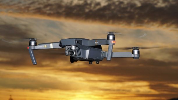
Detroit-based Airspace Link helps connect private drone operators with state and local governments to establish safe flight corridors, and helps provide drone pilots with the data they need to secure Federal Aviation Administration authorization for their operations. The company is an FAA-approved UAS service supplier of the Low Altitude Authorization and Notification Capability (LAANC) system, which provides drone pilots with access to controlled airspace at or below 400 feet.

“If you were to set up these drone highways, it’s really about figuring out the safest areas for the kind of drone I’m going to fly and figuring out the probability of hurting someone on the ground in creating these corridors,” President and CEO Michael Healander said in an interview.

Building a Drone Highway

Earlier this month, Airspace Link announced its partnership with the city of Ontario, California, making Ontario the first city in California to adopt Airspace Link’s AirHub for Government platform, creating a digital drone infrastructure in the sky above the city.

Airspace Link’s technology works with the city’s existing geographic information system (GIS), a mapping system that designates significant landmarks, such as schools, hospitals, jails and the civic center, and which city officials use to manage zoning, traffic counts and speed zones. “Our system pulls in that data, and combines it with the federal rules and regulations. You start to create a ground-based hazard and risk profile that helps to isolate the safest areas to fly through the community,” Healander said.

Through its work with the city, the company also was able to get a better understanding of the airspace requirements around Ontario International Airport. Working with the FAA and the airport, Airspace Link developed a system that opened up almost 20 square miles more airspace for potential drone traffic than had previously been available.

“When they analyzed the air traffic – it goes from east to west — we were able to open up the air space on the north and south sides of the airport for more drone operations for recreational and Part 107 pilots,” Healander said. This could allow delivery companies such as UPS and FedEx to establish operations to the north and south and the airport.

The system also allows city officials to notify drone operators of emergency situations on the ground that could impact flight operations, in the same way the FAA can issue temporary flight restrictions (TRFs) under certain conditions. “If there’s a 911 call, they can create an advisory, just like a TFR,” Healander said.

Supporting Drone Operators

In addition, drone operators can use the data collected through the city’s AirHub system to help them secure FAA waivers allowing for more advanced operations. “Now as a drone operator, if I want to do COVID test kit delivery between hospitals in Ontario, I now have the support of the city,” Healander said. “Having all that data pre-created, I can create a flight plan and it will optimize the flight route and it will give me all the data that’s normally needed by the FAA to build the safety case.”

In the longer term, the establishment of the drone digital infrastructure system in Ontario is expected to have a large impact on the area’s future economic development. Brookfield, the real estate development giant, is using the system’s data to incorporate drone routes and landing sites in its designs for future communities in the region.

Further, Lisa Peterson, Airspace Link’s vice president of business development, said officials in the region are building an autonomous vehicle corridor in the Ontario area “and they’re talking about adding their drone corridor into that project.”

In a short space of time, the start-up technology company has rapidly expanded its footprint across the country. Airspace Link is currently deploying its LAANC system technology in 13 states and is engaged in a two-year project to deploy a statewide system in North Dakota. “We have taken off throughout the U.S,” Healander said. “It’s been an amazing year. We have gone from our first customer nine months ago to over 300 businesses, pilots and state and local governments,”

As with every company across the globe, the global COVID-19 pandemic has had a profound impact on Airspace Link, at first causing a major disruption, but later creating new opportunities for growth. “During the first two months, it was tough for everyone,” Healander said. “It did slow down state and local governments a bit. It took them some time to get back online.”

However, the pandemic also highlighted the need to develop new systems for safe and rapid delivery of medical supplies and tests, and provided an incentive for some government entities to accelerate their plans for developing new drone delivery systems, he said. Airspace Link is working with various government agencies on several projects to establish systems to deliver COVID test kits by drone.

Healander said Airspace Link is making it easier for drone pilots to establish businesses or conduct recreational flights, without having to deal directly with multiple levels of state, county and city government agencies. “We’re doing that for them,” he said.

Miriam McNabb

Miriam McNabb is the Editor-in-Chief of DRONELIFE and CEO of JobForDrones, a professional drone services marketplace, and a fascinated observer of the emerging drone industry and the regulatory environment for drones. Miriam has penned over 3,000 articles focused on the commercial drone space and is an international speaker and recognized figure in the industry.  Miriam has a degree from the University of Chicago and over 20 years of experience in high tech sales and marketing for new technologies.
For drone industry consulting or writing, Email Miriam.

TWITTER:@spaldingbarker

Subscribe to DroneLife here.

Filed Under: Drone News Feeds, Featured, News Tagged With: Airspace Link, Drone Delivery, drone highway, FAA

Reader Interactions

Trackbacks

  1. Drone Highways in the Sky, Digital Transportation Networks - Drone Clever says:
    May 28, 2021 at 6:17 pm

    […] Healander stated Airspace Link is making it simpler for drone pilots to develop services or carry out leisure flights, without needing to deal straight with numerous levels of county, city, and state federal government companies. “We’re doing that for them,” he stated. Source: dronelife […]

    Reply
  2. Drone Highways in the Sky, Digital Transportation Networks. - Drone Clever says:
    May 28, 2021 at 5:29 pm

    […] Healander stated Airspace Link is making it simpler for drone pilots to develop services or carry out leisure flights, without needing to deal straight with numerous levels of county, city, and state federal government companies. “We’re doing that for them,” he stated. Source: dronelife […]

    Reply
  3. Drone Highways in the Sky, Digital Transportation Networks. - Drone Clever says:
    May 28, 2021 at 4:44 pm

    […] Healander stated Airspace Link is making it simpler for drone pilots to develop services or carry out leisure flights, without needing to deal straight with numerous levels of county, city, and state federal government companies. “We’re doing that for them,” he stated. Source: dronelife […]

    Reply
  4. Is your state ready for the expansion of drone delivery? - Pehal News says:
    January 30, 2021 at 8:47 am

    […] have created drone program workplaces and every is exploring the concept of creating “drone highways” — devoted aerial corridors for drone providers above public roadways. Since the FAA will […]

    Reply
  5. 353 Building Drone Highways – Drones Value says:
    December 28, 2020 at 5:58 pm

    […] Digital Drone Highways: a Future Transportation Network […]

    Reply
  6. 353 Building Drone Highways – Drones Velocity says:
    December 28, 2020 at 3:30 pm

    […] Digital Drone Highways: a Future Transportation Network […]

    Reply
  7. Electronic Drone Highways: A Transportation Solution - Drones Today says:
    November 23, 2020 at 10:59 am

    […] Resource website link […]

    Reply
  8. Digital Drone Highways: a Future Transportation Network - Go Drones Blog says:
    November 20, 2020 at 10:51 pm

    […] Airspace Link is building digital drone highways in the air. This Jetson's reminiscent development may be the future of transportation. Source […]

    Reply
  9. 353 Building Drone Highways - Eledonk Electronics says:
    November 20, 2020 at 3:11 pm

    […] Digital Drone Highways: a Future Transportation Network […]

    Reply
  10. 353 Building Drone Highways - The UAV Digest says:
    November 20, 2020 at 10:53 am

    […] Digital Drone Highways: a Future Transportation Network […]

    Reply
  11. Digital Drone Highways: a Future Transportation Network – IAM Network says:
    November 19, 2020 at 9:35 am

    […] READ MORE FROM SOURCE ARTICLE […]

    Reply
  12. Digital Drone Highways: a Future Transportation Network – Top Drones & reviews says:
    November 18, 2020 at 10:04 pm

    […] post Digital Drone Highways: a Future Transportation Network appeared first on […]

    Reply
  13. Digital Drone Highways: a Future Transportation Network - Eledonk Electronics says:
    November 18, 2020 at 1:32 pm

    […] post Digital Drone Highways: a Future Transportation Network appeared first on […]

    Reply
  14. Digital Drone Highways: a Future Transportation Community - Drone Market says:
    November 18, 2020 at 12:33 pm

    […] Supply […]

    Reply
  15. Digital Drone Highways: a Future Transportation Network ⋆ says:
    November 18, 2020 at 9:56 am

    […] The complete article is here […]

    Reply
  16. Digital Drone Highways: a Future Transportation Network – Best Drones Online says:
    November 18, 2020 at 9:48 am

    […] post Digital Drone Highways: a Future Transportation Network appeared first on […]

    Reply
  17. Digital Drone Highways: a Future Transportation Network | Drone Magazine says:
    November 18, 2020 at 8:09 am

    […] Source […]

    Reply

Leave a Reply Cancel reply

Your email address will not be published. Required fields are marked *

Primary Sidebar

LATEST

Eric Trump Invests in XTEND as Israeli Drone Firm Announces Plan to Go Public via Nasdaq Merger

AI-powered robotics company targets $1.5B valuation in U.S. listing Israeli drone and robotics company XTEND has announced plans to go…

Continue Reading Eric Trump Invests in XTEND as Israeli Drone Firm Announces Plan to Go Public via Nasdaq Merger

New Partnership Building Farming Drone Batteries in Texas

KULR Technology Group and Hylio have entered a joint collaboration to produce NDAA-compliant battery systems for agricultural drones built in…

Continue Reading New Partnership Building Farming Drone Batteries in Texas

FlytBase Unveils FlytBase One Management System

FlytBase has introduced FlytBase One, a unified control platform built to connect autonomous drones, robots, and physical infrastructure. The company also…

Continue Reading FlytBase Unveils FlytBase One Management System

Sentrycs Scout Expands Counter-Drone Capabilities for Law Enforcement

Sentrycs, an Ondas Inc. subsidiary specializing in counter-drone technology, has delivered its C-UAS solution to a German State Police department.…

Continue Reading Sentrycs Scout Expands Counter-Drone Capabilities for Law Enforcement

Training for the Threat: FBI Expands Counter-Drone Force Ahead of Historic World Cup

FBI on track to train 60 state, local officers in drone mitigation by June By DRONELIFE Features Editor Jim Magill…

Continue Reading Training for the Threat: FBI Expands Counter-Drone Force Ahead of Historic World Cup

Spexi Orthomosaic Drone Imagery Now Available on SkyWatch Platform

SkyWatch has announced the addition of Spexi orthomosaic drone imagery to its platform, expanding access to standardized aerial data for…

Continue Reading Spexi Orthomosaic Drone Imagery Now Available on SkyWatch Platform

From Munich Security Conference to Capability Priorities — Why Drones and C-UAS Are Now Core to Europe’s Defense Doctrine

As Europe’s premier strategic security forum, the 62nd Munich Security Conference (MSC 2026) offered more than its usual round of…

Continue Reading From Munich Security Conference to Capability Priorities — Why Drones and C-UAS Are Now Core to Europe’s Defense Doctrine

Auterion and Airlogix Partner to Scale Autonomous Drone Production

German drone software provider Auterion and Ukrainian defense company Airlogix have formed a joint venture to produce AI-guided unmanned aerial…

Continue Reading Auterion and Airlogix Partner to Scale Autonomous Drone Production

Wingcopter, TAF Industries Partner For Joint UAV Manufacturing

German drone manufacturer Wingcopter and Ukraine’s TAF Industries have announced plans to form a joint venture focused on scaling production…

Continue Reading Wingcopter, TAF Industries Partner For Joint UAV Manufacturing

EU Commission Releases Action Plan For European Counter-UAS

By Dronelife Features Editor Jim Magill The European Commission, the executive body of the EU, on February 11 issued an…

Continue Reading EU Commission Releases Action Plan For European Counter-UAS

Secondary Sidebar

Footer

SPONSORED

Inspired Flight Gremsy IF800 VIO F1 drones geo week

What Will It Take to Strengthen U.S. Drone Manufacturing? A Conversation with Inspired Flight’s CEO

Global Mapper Mobile data collection

Collection Ground Control Points with Global Mapper Mobile

Military Drone Mapping Solutions

How SimActive’s Correlator3D™ is Revolutionizing Military Mapping: An Exclusive Interview with CEO Philippe Simard

Photogrammetry Accuracy Standards

SimActive Photogrammetry Software: Enabling Users to Meet Accuracy Standards for Over 20 Years

NACT Engineering Parrot ANAFI tether indoor shot

Smart Tether for Parrot ANAFI USA from NACT Engineering

Blue Marble, features global mapper, features Blue Marble

Check Out These New Features in Global Mapper v25 from Blue Marble

About Us | Contact Us | Advertise With Us | Write for Us | Privacy Policy | Terms of Service

The Trusted Source for the Business of Drones.

This website uses cookies and third party services. By clicking OK, you are agreeing to our privacy policy. ACCEPT

Manage consent

Privacy Overview

This website uses cookies to improve your experience while you navigate through the website. Out of these, the cookies that are categorized as necessary are stored on your browser as they are essential for the working of basic functionalities of the website. We also use third-party cookies that help us analyze and understand how you use this website. These cookies will be stored in your browser only with your consent. You also have the option to opt-out of these cookies. But opting out of some of these cookies may affect your browsing experience.
Necessary
Always Enabled
Necessary cookies are absolutely essential for the website to function properly. These cookies ensure basic functionalities and security features of the website, anonymously.
CookieDurationDescription
cookielawinfo-checkbox-analytics11 monthsThis cookie is set by GDPR Cookie Consent plugin. The cookie is used to store the user consent for the cookies in the category "Analytics".
cookielawinfo-checkbox-functional11 monthsThe cookie is set by GDPR cookie consent to record the user consent for the cookies in the category "Functional".
cookielawinfo-checkbox-necessary11 monthsThis cookie is set by GDPR Cookie Consent plugin. The cookies is used to store the user consent for the cookies in the category "Necessary".
cookielawinfo-checkbox-others11 monthsThis cookie is set by GDPR Cookie Consent plugin. The cookie is used to store the user consent for the cookies in the category "Other.
cookielawinfo-checkbox-performance11 monthsThis cookie is set by GDPR Cookie Consent plugin. The cookie is used to store the user consent for the cookies in the category "Performance".
viewed_cookie_policy11 monthsThe cookie is set by the GDPR Cookie Consent plugin and is used to store whether or not user has consented to the use of cookies. It does not store any personal data.
Functional
Functional cookies help to perform certain functionalities like sharing the content of the website on social media platforms, collect feedbacks, and other third-party features.
Performance
Performance cookies are used to understand and analyze the key performance indexes of the website which helps in delivering a better user experience for the visitors.
Analytics
Analytical cookies are used to understand how visitors interact with the website. These cookies help provide information on metrics the number of visitors, bounce rate, traffic source, etc.
Advertisement
Advertisement cookies are used to provide visitors with relevant ads and marketing campaigns. These cookies track visitors across websites and collect information to provide customized ads.
Others
Other uncategorized cookies are those that are being analyzed and have not been classified into a category as yet.
SAVE & ACCEPT