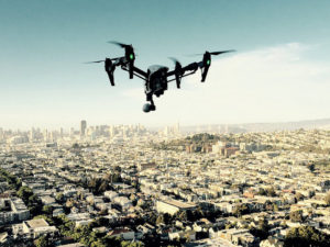
You could see this coming, and now it’s an official announcement. AirMap has partnered with drone detection technology provider Fortem Technologies to provide a solution that will allow cities to detect all drones in the air, both cooperative and non-cooperative. These will be shared with the AirMap platform, which will match against planned operations – and tag unauthorized drones as rogue.
Here’s how it works.
The following is an AirMap and Fortem press release.
AirMap and Fortem Technologies Announce Collaboration to Provide Holistic UTM and U-Space Solution
Solution Will Equip Cities or Designated Regions with the Ability to Track Cooperative and Non-Cooperative Drone Operations
MADRID, March 12, 2019 — World ATM Congress — Today, AirMap, a leading global Unmanned aerial system Traffic Management (UTM) platform, and Fortem Technologies, a leading airspace awareness, safety and security company, announced that they will collaborate to provide an integrated solution that allows for the safe operation of drones within geofences while also enforcing no-fly zones in cities, around airports and other critical infrastructure.
The Fortem and AirMap collaboration follows the UTM and U-Space industry model of a UAS Service Supplier (USS) and Supplemental Data Service Provider (SDSP). Fortem SkyDome™, enabled by distributed Fortem TrueView™ radar, acts as the SDSP, a data service platform for drone applications. Fortem SkyDome collects and aggregates real-time airspace data, creating corridors and geofences in the sky. AirMap acts as the USS by publishing airspace rules to operators, drone manufacturers, and app developers to stay within the Fortem corridors and away from the Fortem-protected no-fly zones.
Functionally, Fortem SkyDome will detect all airborne objects, cooperative or uncooperative, and share this information with the AirMap UTM platform, matching detected objects against their known operations. Any aircraft detected by Fortem SkyDome that is not participating within the set guidelines in the UTM system is distinguished as rogue for immediate intervention by appropriate authorities or the Fortem DroneHunter.™ AirMap will further utilize Fortem TrueView™ radar data to provide risk mitigation services for the enablement of beyond visual line-of-sight operations within the Specific Operations Risk Assessment (SORA) framework.
“Fortem digitizes the airspace above and around infrastructures, campuses, venues and cities, to enable safe and reliable drone services,” said Timothy Bean, CEO, Fortem Technologies. “Our low-cost, networkable system supports USSs like AirMap to pave the way for drone package delivery, autonomous people transportation, and general urban air mobility.”
“The rapid increase in drone operations brings tremendous benefit to society in the way of public safety, medical logistics, infrastructure inspection, and more. However, at the same time we are seeing a rapid increase in airport disruptions due to drone sightings,” said AirMap Chairman and Cofounder Ben Marcus. “Combining AirMap’s industry-leading UTM for ‘known’ good drones with Fortem’s industry-leading technology to detect both welcomed and ‘unknown’ bad drones.”
About AirMap
AirMap is the world’s leading airspace management platform for UAS, otherwise known as drones. Industry developers, drone operators, and airspace managers rely on AirMap’s airspace intelligence and services to fly safely and communicate in low-altitude airspace. AirMap unlocks safe, efficient, and scalable operations by connecting the world’s drones to airspace authorities through an open platform of APIs and SDKs, with integrations by top drone manufacturers and solution providers including 3DR, DJI, DroneDeploy, Intel, Matternet, and senseFly. Deployed in the Czech Republic, Japan, Switzerland, the United States, and available in over 25 countries, AirMap leads the industry in delivering technology solutions for UAS Traffic Management (UTM) and U-space to enable safe and responsible drone operations at scale. AirMap supports several drone enablement and research projects globally, including NASA UTM, SESAR’s European Network of U-space Demonstrators and the United State’s UAS Integration Pilot Programs.
Learn more about the AirMap UTM Platform at: www.airmap.com
About Fortem Technologies:
Fortem Technologies is the leader in airspace awareness, safety and security for a drone world. Fortem’s end-to-end solutions provide the location of all objects in the sky over designated areas – from sites to cities or entire regions – to create, manage, police and enforce designated boundaries autonomously. Some of the world’s leading airports, hospitals, sports stadiums and defense establishments use Fortem’s innovative technologies. Based in Pleasant Grove, Utah, the company is privately held and backed by DCVC, Boeing, Signia Venture Partners, Mubadala Capital – Ventures, and others. More at www.fortemtech.com.

Miriam McNabb is the Editor-in-Chief of DRONELIFE and CEO of JobForDrones, a professional drone services marketplace, and a fascinated observer of the emerging drone industry and the regulatory environment for drones. Miriam has penned over 3,000 articles focused on the commercial drone space and is an international speaker and recognized figure in the industry. Miriam has a degree from the University of Chicago and over 20 years of experience in high tech sales and marketing for new technologies.
For drone industry consulting or writing, Email Miriam.
TWITTER:@spaldingbarker
Subscribe to DroneLife here.


[…] By Miriam McNabb, March 14th, 2019 Read on dronelife.com→ […]