At One of America’s Deadliest Attractions, Drone Pilots Fill in Where Law Enforcement Falls Short in One of the Most Innovative Civilian Search and Recovery Operations Ever.
Guest post: Author and DroneUp insider Austin Walker describes the DroneUp Rescue Operation at Amboy Crater. DroneUp is a global fleet of certified drone pilots with sophisticated mission management, revolutionizing drone services.
Do your best to imagine these harrowing circumstances: You are hiking the mile-and-a-half trail up to Amboy Crater, an extinct volcano in California’s brutal Mojave Desert during a record-breaking heatwave. The bone-dry air has reached 120 degrees by noon and the black volcanic cinder on the ground beneath you is radiating unforgiving heat. There is no shade. You have run out of water (your body loses more than two quarts each hour you hike in these conditions).
Your mouth is dry, your body is incapable of producing sweat. As you continue to realize the severity of your situation, you begin walking towards the only civilization you can see—it is two miles away. Meanwhile, your central nervous system is diverting blood away from your central organs to your skin in a desperate attempt to cool it. You are overwhelmingly nauseated. Once your core temperature hits 104 degrees, the pressure in your skull is too much for your brain to function properly (the point at which your condition is qualified as heatstroke).
You are delirious and dizzy to the point you likely do not realize your organs are shutting down. Eventually, you lose consciousness and collapse into the bright, burning sand beneath you. You are dead within minutes.
This is the fate that befell William Schmierer, a 64-year-old from Williamsburg, Virginia who was on a cross-country road trip with his wife, Susan, in June of this year. The San Bernardino County Sheriff’s Department received a notice of a vehicle parked at the Amboy Crater trailhead for 10 days, and a search and rescue operation commenced. Mr. Schmierer was found in three days and the coroner’s office determined his body had reached a point of “advanced decomposition.”
Susan Schmierer was nowhere to be found, though. Because of the extremely hazardous conditions of the area, the recovery operation for her body was restricted to the cooler, early morning hours. Even then, the sheriff’s aviation unit, along with the volunteer search and rescue crew, were unable to find her after days of searching. The temperatures were so severe that their helicopter was unable to fly some days because the heat rising off the ground made it so they could not generate lift from the rotor.
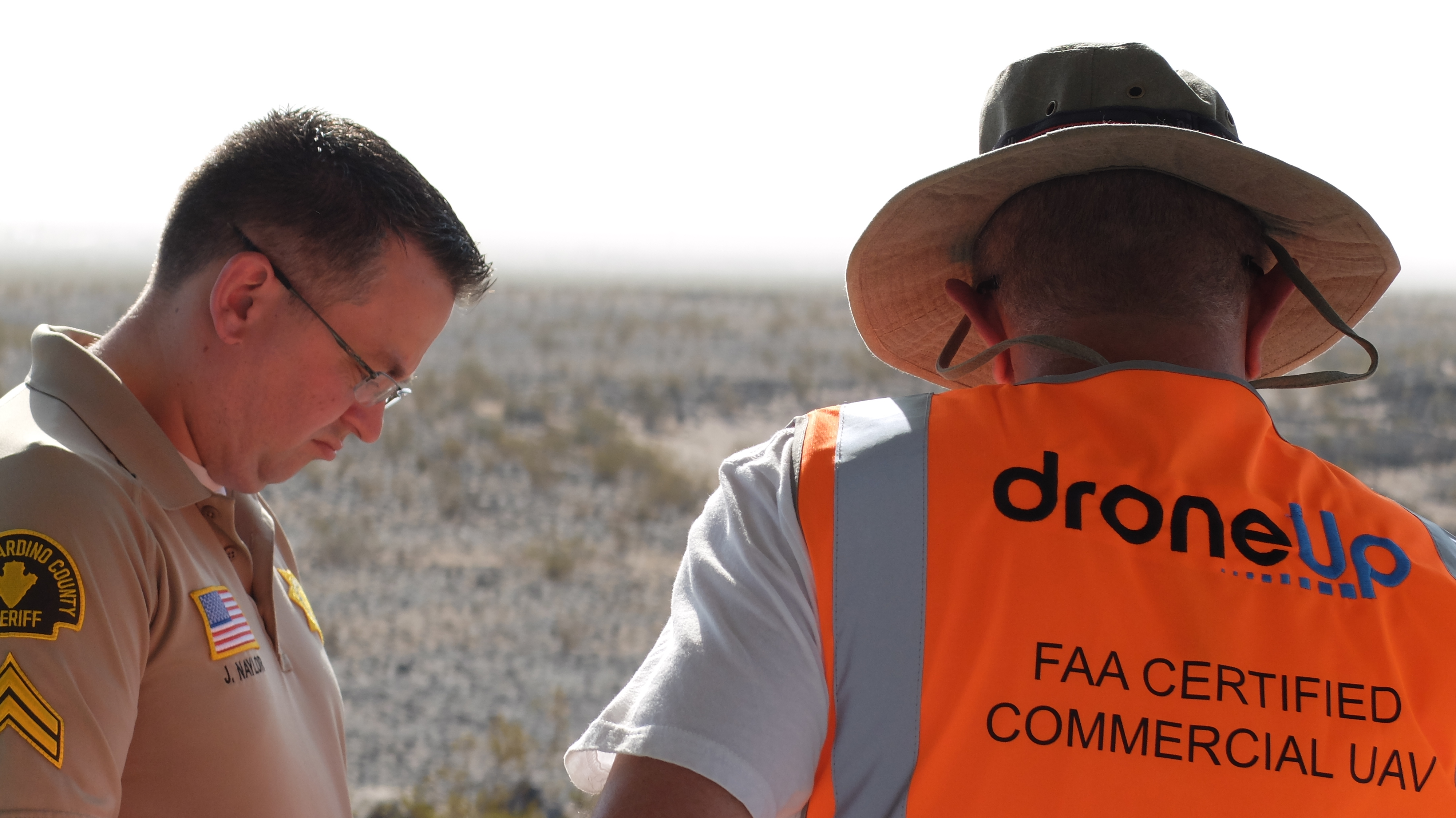
Sergeant Derek Garvin is the coordinator of search and rescue operations for the San Bernardino County Sheriff’s Department. His unit is in charge of the entire Joshua Tree National Park, an area of about 2,600 square miles.
“Out here in this Amboy area, we’ve had several fatalities in the past couple of years. This is the only one in the last three years that has gone on this long,” he said about three weeks into the search. “During the summer, this is probably the most difficult patch of real estate that we patrol.”
Realizing that something else had to be done, people watching the case contacted Anthony Vittone, the Chief Operating Officer of DroneUp, to see if they could assist in any way. Vittone relayed the message to the organization’s leadership.

DroneUp is a Virginia-based company that specializes in unique applications of unmanned aerial vehicles. The company has created an app, similar to popular ridesharing services, which allows users to register and agree to assist in “missions” that require unmanned aerial vehicles. With a registry of nearly 4,000 commercial pilots across the country, DroneUp is capable of mobilizing advanced, civilian aerial surveillance and assistance during emergencies.
In the devastation that followed Hurricane Harvey, DroneUp was flying missions over Texas to find stranded families and assess the overall damages done by the flooding. They have mobilized over the wildfires in California and have assisted law enforcement in fugitive recovery.
DroneUp President Tom Walker wanted to know if they could request pilots to go out and assist. Craig Coker, DroneUp’s Chief Pilot, lives in San Diego and agreed to go out and find out what kind of conditions they would be working with. After some assessment, and a realization that they needed a sophisticated, hands-on operation, DroneUp agreed to assist with recovery operations pro bono. Their two-phase approach to the challenge was comprehensive and groundbreaking; it was recognized by the sheriff’s department as far surpassing their capabilities given the circumstances.
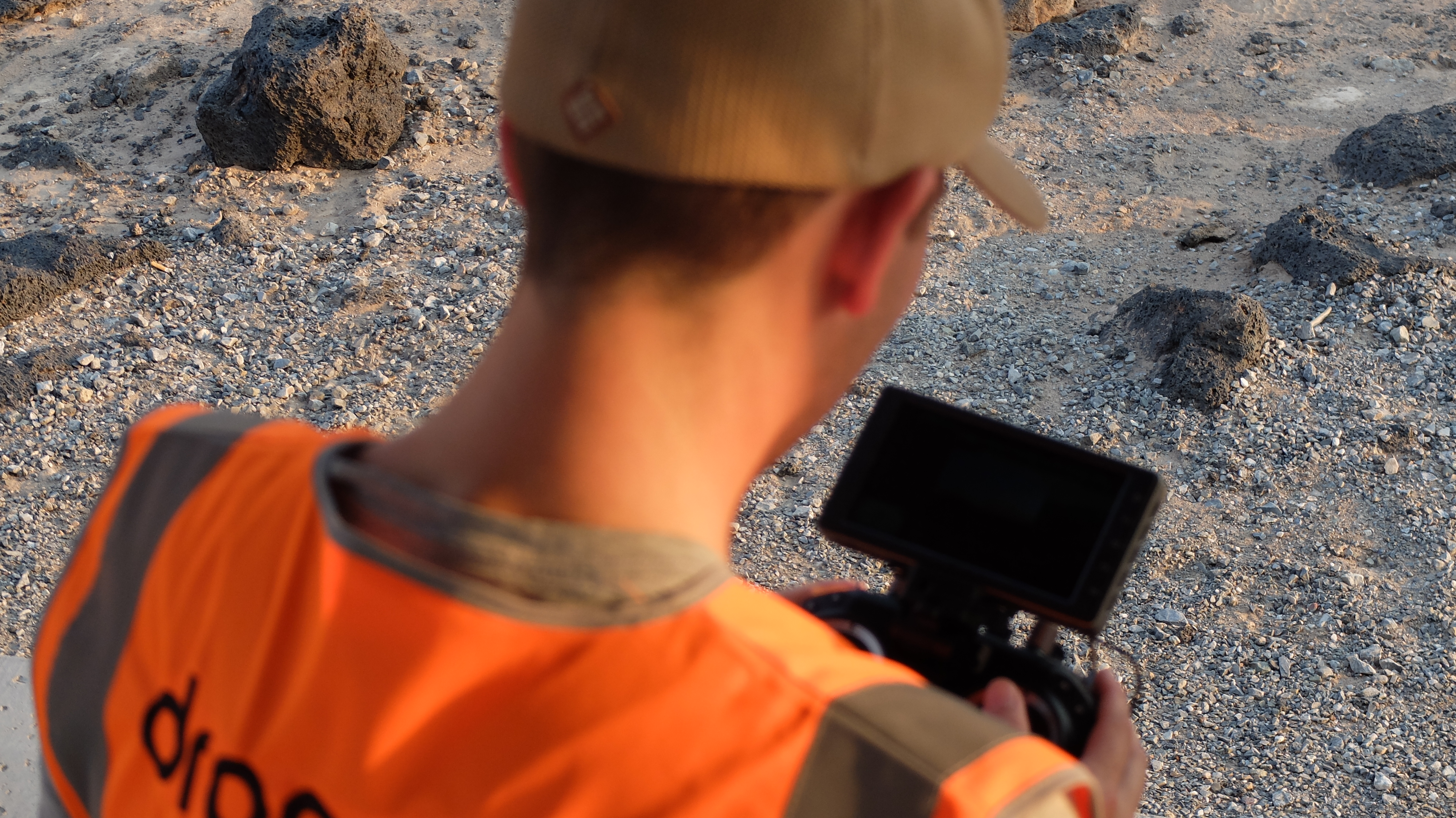
For this operation, DroneUp did something they hadn’t done yet. They established a mobile command unit in the parking lot at the trailhead of Amboy Crater in a rented RV. A combination of the area’s distance from modern comforts and resources and the necessity to fly operations in the early, cooler hours meant they needed to be as close as possible to the search area. Three drone pilots and one assistant crammed into the vehicle, preparing to spend most of their day sheltering themselves from the heat and looking over data.
Phase One consisted of surveilling the more than 25-square-mile area, taking thousands of high-resolution photographs that were pieced together using Icaros, which turned them into interactive, 360-degree images. They then took these images and, in collaboration with Hangar Technology, invited almost 80 pilots in their registry to review the data, flagging points-of-interest on a scale of one-to-five depending on how much they resembled a human body. The volunteers completed 180 hours of analysis and submitted 120 points-of-interest, the coordinates of which were handed over to the pilots who prioritized them during their aerial searches. Phase Two commenced once the pilots began flying manned and unmanned scans of the area, focusing on the clues.
The pilots were coordinating closely with the sheriff’s department, who were still launching foot patrols and ATVs into the area weeks after Mr. Schmierer’s body was found. At one point, the family suggested that Susan Schmierer might have been wearing bright blue hiking shoes with reflective markers. The volunteers on foot had something to look for, and the pilots launched a series of flights at night, hoping their infrared cameras might reflect off the shoes, making them easier to spot.
Law enforcement noted that they were able to find Mr. Schmierer’s body because of the vultures that had circled overhead. Using this information, the drone pilots responded to any vultures in the air by following them to wherever they landed and creating a 360-degree image. They were also able to fly down low, just a few feet off of the ground, and pan over the scene. During one of these efforts, the pilots obtained the coordinates of where a vulture had landed and a search party went out to the area. It turned out, though, to be the half-eaten body of a black-tailed jackrabbit.
One particular demonstration of the value of the drones came about during an on-foot search by members of the DroneUp team. In their furthest venture from the base camp, they had fears that they would run out of water on their 1.5 mile return. They radioed to the pilots that they needed a resupply of water and within minutes DroneUp had attached a small package containing cold water and granola bars to a DJI Mavic Pro 2. They were able to fly it out to the party and drop it for them, helping them to search further.
Despite all of these efforts, the body of Susan Schmierer has yet to be found. Detective Jacob Naylor with the sheriff’s department said it is unlikely she would be found at this point. Judging by the time she’d been out in the sun, the clothes she was wearing would have been reduced to sunbleached rags, and her skin would be like black leather—nearly indiscernible from the volcanic cinder she might have been initially propped up against.
“Usually it’s very easy to find the people,” Naylor said. “What differentiates this case from the others is we didn’t know they were missing until a couple of weeks after they got here. If we had been out here sooner, our scent dogs would have been able to pick up on her scent, where they might have walked. Time is very critical.”
Their conventional tracking methods, like footprints and bloodhounds or leftover items, weren’t effective because of how long it had been and how quickly the environment would’ve destroyed that evidence. Within one week, for example, any footprint would be entirely erased and a person’s scent wouldn’t be detectable by bloodhounds.
“Ideally, we could incorporate this kind of technology into our department. DroneUp has been a big help, and we really have appreciated having them out here,” Naylor said. “Of course, the negative side of that tech, at least with our department, is the negative public perception associated with (unmanned aerial vehicles). Spying, and that kind of thing. Trying to get public support, I think, is going to have to come from situations like this where the tech can prove its value and worth.”
Law enforcement and emergency services around the country have implemented drones in a number of ways, and the responses have been mixed. The Fire Department of New York unveiled a tethered drone last year which is able to provide live video of firefighting operations in the city’s highrises. More than 300 law enforcement departments have adopted UAV technology in the past two years to assist in fugitive recovery, active shooter situations and search and rescue operations. Concerns over privacy have been voiced, but the value of the technology seems to have surpassed, for many departments, the negative press.

“I would like to see more drone activity,” Naylor said. “Doing what DroneUp has done, with actual people on the ground, would be next to impossible. When you have a situation like this, where the terrain is horrible, the environment is obviously deadly because of the heat, using unmanned craft is, in my opinion, very beneficial.”
Despite their failure to find the body, many people within DroneUp consider their Amboy operations a success. They were able to demonstrate the capabilities of their technologies, and they attracted the attention of public service officials and organizations across the country. They showcased their findings at this year’s InterDrone conference, one of the world’s largest UAV-related conferences, in the hopes of attracting the attention of public service officials who might be unsure of how the technology could be useful for their departments.
 Journalist Austin Walker is the former Managing Editor of the Commonwealth Times; a former Editorial Intern at Richmond Magazine, and a former Communications Intern with the Office of Senator Adam Ebbin. Follow Austin on Twitter: @AWalk3r.


[…] disabled at least one of the search vehicles. Another search team looking for Susan’s body using drones also came up empty last […]