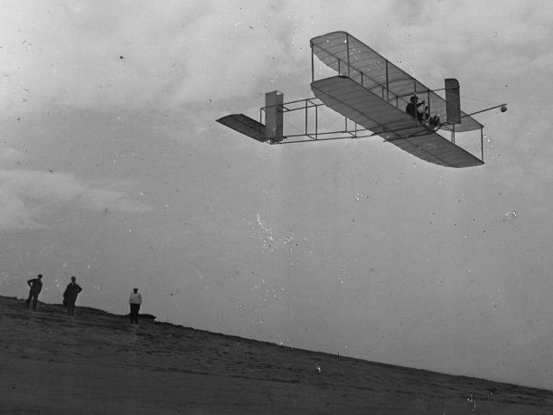
Commercial drone adoption is currently at an all-time high. But we’re still far from where drones are fully integrated into the processes that make businesses grow. Maybe we are not quite as the level of the pioneers of aviation like the Wright brothers were but let’s agree that we are early in the process. As builders, growers, engineers, and the like continue to scale their drone operations the applications use increasing amount of data to make better decisions and a larger percentage of the total number of applications will use drones and the data that they can provide. The amount of drone data collected is only going to rise as will the importance of the data that drones provide.
While it’s exciting to see companies gather more drone data, sometimes, additional information can be more of a burden than a benefit. How do you make sense of all this data and streamline the decision-making process? No one wants to pour over large amounts of files manually looking for exceptions or to be able to identify those characteristics that allow user to be able to gauge progress, show volume, or find exceptions from a standard.
DroneLife reached out to CEO David Tran of Optelos on the importance of integrating with DroneDeploy.
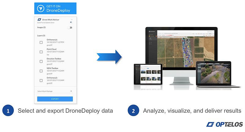
“We are thrilled to be working with DroneDeploy and helping customers streamline the inspection and analysis of their drone data. Our customers can seamlessly export their DroneDeploy results such as Orthomosaics, Point Clouds, and imagery directly into Optelos. They can then use our powerful inspection and analytics tools to complete their deliverables to clients faster than ever before. Customers want actionable answers, so our goal at Optelos is to work with our partners, like DroneDeploy, to create a streamlined workflow that transforms data into business decision-enabling insights as quickly as possible.”
So let’s dig down a little deeper, the Optelos Drone Work Advisor™ app. app seamlessly transfers your collected and processed data from DroneDeploy straight into the Optelos’ Drone Work Advisor™ platform.

Optelos has a comprehensive suite of tools that link together images, videos, maps, 2D Orthomosaics, and 3D models in a simple dashboard.
You can also inspect, annotate and tag images, and view other media types including panoramas, PDFs, and Microsoft Word, PowerPoint, and Excel documents.
Compare Orthomosaics, Digital Elevation Models, and More Side by Side
As an example you can quickly overlay orthomosaics makes it simple to see site progress or compare maps to elevation models instantly. Useful for applications in construction or mining.
Assign Tasks, Highlight Issues and add Descriptions to Drone Imagery
As you work through your maps and photos, you can annotate the data to assign tasks, submit descriptions, and tag issues quickly — all of which is searchable using filters. Allowing your team to work on the data more effectively where the data collection and analysis may very well be done by different people.
Automate Analysis with AI-Powered Insights built into the Optelos toolset
Optelos offers Enterprise customers the ability to automate image inspection. By identifying and tagging known issues such as roof damage, broken solar cells, and more, it shortens the amount of time necessary to review data files. This eliminates time spent poring through images from visual inspections and tagging issues manually. In many cases, AI can identify those problems that a operator might miss freeing them up to do other things.
Share Data and Generate Customized Reports
Once data has been analyzed, it’s easy to share your insights with key stakeholders. You can either share folders directly or generate custom reports in PDF and HTML formats.
Want to start taking advantage of the combined power of DroneDeploy and Optelos? Add the Optelos Drone Work Advisor™ app to your DroneDeploy Dashboard to get started.
You can learn more at Optelos. Much of this information was first published at DroneDeploy. Learn more about some some cool new AI and Machine Learning features just announced by DroneDeploy.
Going to Interdrone? You can learn how best to check these companies out at our guide at DroneLife guide to Interdrone.
