The National Oceanic and Atmospheric Administration (NOAA) is at the forefront of the fight to save the planet – and they’ll use any tool available to do so. Here are three incredible ways that NOAA’s drones are saving the environment.
NOAA’s unmanned systems program is a research project, explains Robbie Hood, Director of the Unmanned Aircraft Systems Program at NOAA. “It’s an exploratory program to evaluate how useful the drones will be,” Ms. Hood says. “Our real job is to help people understand both what’s happening today and what’s going to happen tomorrow… and that takes a lot of data. Unmanned technology can help us get data that we can’t get any other way.”
NOAA uses drones in several different ways; sometimes because drones are simply more efficient, and other times because they are the safest option – either for people or for wildlife. Drones are used in research about high impact weather, marine observations, and polar regions. In every situation that NOAA is researching, Ms. Hood explains, information is key. “Can we collect data that can help us understand what is changing?”
High impact weather events – events like tornadoes, hurricanes, or tropical storms that will have a significant effect on people’s safety and the economy – are by definition dangerous to track. That’s when a drone can be utilized, gathering data in areas that could be hazardous for researchers.
In the polar regions, where extreme conditions and seas make research difficult, “There are several applications,” says Hood. “In the polar regions, there is a lot happening with ice change – being able to get a more detailed map of the ice is critical.” This summer, a Saildrone, attached to the NOAA Ship Oscar Dyson, will study ocean conditions in the Bering Sea. The Saildrone will gather data from the Arctic and beam it back to researchers at NOAA’s Pacific Marine Environmental Laboratory; the drone will capture data about the ocean environment and wildlife such as whales and seals. “Using UAS from a ship can significantly increase the observing radius of the ship,” Hood points out.
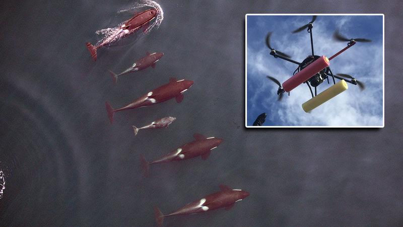
In other cases, using a drone is the best solution for the environment. Earlier this year, NOAA used small hexacopter drones to track the health of endangered killer whales. Using the precise drone photogrammetry – which is the science of taking measurements from images – they were able to accurately establish pod health, all without disturbing the whales. “We can’t put a live whale on a scale to assess its weight and overall health,” NOAA researcher John Durban said in a NOAA article. “But now we can give it a remote checkup without it even knowing we are there.”
Sometimes the environment itself is better off for not being stepped on. And NOAA is using drones to monitor those delicate ecosystems, like marsh wetlands in Mississippi. Researchers used drones launched from ships in 2015 in order to gather data about the extent of damage right after a lightning strike caused a huge marsh fire along the Mississippi coast.
NOAA says that drones are proving to be cost-effective, fast, and safe – all good news for both researchers and the growing drone industry, anxious to demonstrate that drones can be good for everyone – including the planet.
Miriam McNabb is the Editor-in-Chief of DRONELIFE and CEO of JobForDrones, a professional drone services marketplace, and a fascinated observer of the emerging drone industry and the regulatory environment for drones. Miriam has penned over 3,000 articles focused on the commercial drone space and is an international speaker and recognized figure in the industry. Miriam has a degree from the University of Chicago and over 20 years of experience in high tech sales and marketing for new technologies.
For drone industry consulting or writing, Email Miriam.
TWITTER:@spaldingbarker
Subscribe to DroneLife here.