While all drone technology is recent, the benefits to some sectors – like agriculture and construction – are so significant that some new applications have been broadly adopted as fast as the technology is developed.
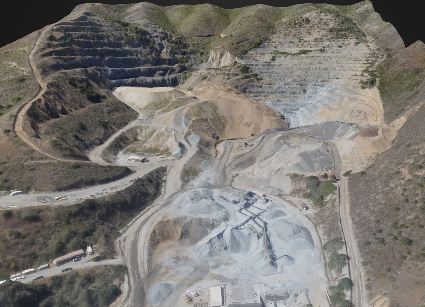
DroneDeploy, a Silicon Valley tech company that develops software for commercial drones, announced today a milestone of 1 million acres of drone data. With 40% of DroneDeploy’s user data related to agriculture, giving farmers the opportunity to get a bird’s eye view of their fields, hundreds of users from around the world have now uploaded their data to DroneDeploy for processing. The data allows users to identify pests, water damage, irrigation issues, and determine the right time to harvest.
The company is also announcing what it believes to be the world’s longest commercial drone map. Over 114,000 images were processed from 869 flights over Mexican highways in a project executed by mapper Sergio Serrato of Skylab Industries. Serrato says they were happy to find DroneDeploy, as other applications were unable to handle the huge volume of data that the project required. “[The] scalability is what enabled us to complete this data collection operation on time,” recounts Serrato. “We undertook a huge project to create a highly accurate map of 1,000 kilometers of highway.”
DroneDeploy views the 1,000,000 acre milestone – and the 1,000 km highway map – as a successful test of the technology’s ability to scale, supporting large fleets of drones and large amounts of data. “Now that our technology’s scalability has been proven, we migrate out of beta,” informs Nick Pilkington, CTO. “Today, we’re launching our service with a free tier, enabling anyone to produce high-quality maps and 3D models.”
DroneDeploy’s announcement that it has now launched their software for free to anyone in over 120 countries will open the door to new applications, as consumers find their own uses for the technology. DroneDeploy’s free mobile app is currently available for Android devices through Google Play . The software allows users to automate mapping flights for drones manufactured by DJI. An iOS app is slated for release in the coming weeks.

Miriam McNabb is the Editor-in-Chief of DRONELIFE and CEO of JobForDrones, a professional drone services marketplace, and a fascinated observer of the emerging drone industry and the regulatory environment for drones. Miriam has penned over 3,000 articles focused on the commercial drone space and is an international speaker and recognized figure in the industry. Miriam has a degree from the University of Chicago and over 20 years of experience in high tech sales and marketing for new technologies.
For drone industry consulting or writing, Email Miriam.
TWITTER:@spaldingbarker
Subscribe to DroneLife here.


I am looking for the UAV/Drone helicopter
powered by gas.
valid loading minimum 200-250 Lbs.
for the purpose of agricultural crops & fruit’s three
to spraying chemicals with or fertilze a fields
unable to find the company through the internets
would refere me to your friends ot whom makes
this drone herculize Helicopter
or the company
It would be gratefull
my e-maile add: ip88chi@yahoo.com
my cell-phone # 909-709-3637
thank you
God bless you
I’m not sure it’s the ‘world’s largest.’ Researchers and others have similarly sized datasets and images. Check out ours:
https://youtu.be/ih6o4upHiFU
https://youtu.be/rCQXJrDZibg
https://youtu.be/PovvszUZxcY
https://youtu.be/UEgwfYheWTU