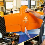
Swiss drone manufacturer Wingtra has announced their next generation offering, the WingtraOne GEN II—a VTOL drone with an oblique payload and advanced reliability algorithms for the ultimate 3D drone mapping data capture. "GEN II reflects 100,000 flights worth of intelligence taken on by a dedicated team of engineers who translated it into leading-edge reliability, safety … [Read more...] about 3D Drone Mapping Data Capture: WingtraOne GEN II’s Oblique Camera Configuration
Wingtra
Pix4D and Wingtra: New Integration Makes Orthomosaic and Point Cloud Generation 2X Faster
Wingtra's recent WingtraHub 1.0 release introduces a lean workflow between the WingtraOne drone and Pix4Dmatic, a "fresh Pix4D product for reliable speedy processing of large datasets," says a Wingtra press release. "This integration is especially key since Wingtra's VTOL drone is designed to map large sites fast and safely while providing the best possible data quality. The … [Read more...] about Pix4D and Wingtra: New Integration Makes Orthomosaic and Point Cloud Generation 2X Faster
Orthophoto Survey Drones Help Predict Flash Flooding
Orthophoto survey drones are providing new insights to scientists tracking ice and water levels in Alaska. A research team led by Gabriel Wolken of the University of Alaska Fairbank's Climate Adaptation Science Center has been measuring rising and falling ice and water levels in Suicide Basin glacial lake just outside Juneau. By working to visualize and predict the … [Read more...] about Orthophoto Survey Drones Help Predict Flash Flooding
SimActive and Wingtra Work Together to Produce Stunning, High Accuracy Results
When it comes to enterprise drone applications, it's all about the data - and the drone. Swiss provider Wingtra, a leading provider of VTOL hybrid drones for industry, has partnered with SimActive, the makers of Correlator 3D software, to offer customers rapid processing of high accuracy maps and survey data. “The high-quality data collected with our WingtraOne PPK drone is … [Read more...] about SimActive and Wingtra Work Together to Produce Stunning, High Accuracy Results
VTOL Drone Firm Wingtra Creates Certification Service Process with RDO
Swiss drone manufacturer Wingtra is teaming up with distributor RDO Equipment to roll out a certified repair center servicing the company’s vertical-takeoff-and-landing drone solutions. The certification program will reduce downtown for Wingtra’s survey drones within RDO’s domestic coverage area across the American Upper Midwest, Pacific Northwest, and Southwest. RDO will … [Read more...] about VTOL Drone Firm Wingtra Creates Certification Service Process with RDO


