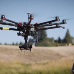
The commercial market for drone operators is expanding, and that's good news for the industry. Insurance, construction, inspections and security firms are all increasing their adoption of drone technology. But the pool of licensed drone operators is expanding too - and that can make it difficult to stand out and get hired. The best way to boost your career as a licensed … [Read more...] about The Best Way to Boost Your Career as a Drone Operator: Up Your Skills to Something Specific
Thermal Imaging
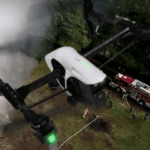
Aerial Thermal Imaging for Emergency Services: the FLIR Expert Webinar
Leading thermal imaging solutions provider FLIR is helping the public safety sector get on board with drones. "Of all the uses of this technology, this to me is by far the most important," says FLIR's global sales manager and webinar presenter Randall Warnas. The webinar offers a must-see overview for anyone connected to the public safety sector in drones: solution … [Read more...] about Aerial Thermal Imaging for Emergency Services: the FLIR Expert Webinar
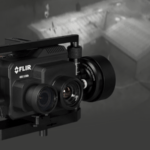
The FLIR Duo Pro R: A Powerful, Professional Tool for Drones Built for the Future
In a webinar held earlier this month, thermal imaging leader FLIR introduced the details of the DuoPro R, scheduled to ship late this month. The new product was announced at this year's InterDrone conference - it's a premium professional tool designed specifically for drone use. "The ultimate drone thermal imaging solution is here," says FLIR, and if the language seems a … [Read more...] about The FLIR Duo Pro R: A Powerful, Professional Tool for Drones Built for the Future
Watch: Using a FLIR Thermal Camera to Track Whales
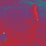
Our friends at Ocean Alliance have been using drones to collect samples from whales, identify them in the wild and track their movements from above. Over the summer they were in Alaska and, with the help of Intel's algorithms, were able to spot different species in the water despite poor visibility. The Ocean Alliance team also got a chance to test out some new equipment, which … [Read more...] about Watch: Using a FLIR Thermal Camera to Track Whales
FLIR Introduces FLIR Duo Pro R Dual Sensor Commercial Drone Camera
FLIR has announced the FLIR Duo Pro R dual sensor thermal imaging and mapping system for commercial drones. Featuring a thermal sensor with radiometry, the FLIR Duo Pro R gives professional drone operators the range and image detail needed to capture actionable thermal and visible data in a single flight. The FLIR Duo Pro R ushers in a new era of imaging capability for a wide … [Read more...] about FLIR Introduces FLIR Duo Pro R Dual Sensor Commercial Drone Camera


