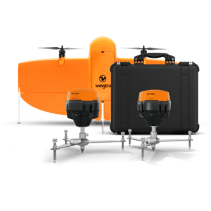
New all-in-one system integrates drone, field setup, and processing to simplify high-accuracy aerial mapping for surveyors of all experience levels. by DRONELIFE Staff Writer Ian J. McNabb Zurich, Switzerland-based drone developers Wingtra recently announced their new WingtraGROUND system, a new ground-control solution designed for the surveying space that combines “drone, … [Read more...] about Wingtra Unveils WingtraGROUND: A Seamless Ground Control Solution for Drone Surveying
surveyor tools
Revolutionizing Drone Operations: Wingtra Unveils WingtraCLOUD Software
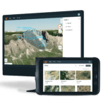
Simplifying Data Collection and Enhancing Collaboration with User-Friendly Features for Surveyors and Pilots by DRONELIFE Staff Writer Ian J. McNabb Swiss developer Wingtra, a leader in the VTOL mapping space, recently announced the unveiling of its new WingtraCLOUD software, designed to “revolutionize the way customers expand their drone programs and operations.” … [Read more...] about Revolutionizing Drone Operations: Wingtra Unveils WingtraCLOUD Software


