
New survey-grade sensors offer precision mapping at accessible price points, bringing professional LiDAR technology to a wider audience. by DRONELIFE Staff Writer Ian J. McNabb Alabama-based LiDAR (Light Detection and Ranging) technology developer GeoCue announced their newest additions to their TrueView lineup of sensors- the TV1 and the TV1 Lite. These new, survey-grade … [Read more...] about GeoCue Expands TrueView Lineup with TV1 and TV1 Lite: Affordable, High-Performance LiDAR for Drone Surveys
Mapping solutions
Affordable Mapping Revolution: AerologixMaps Empowers Drone Businesses
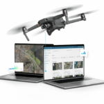
AerologixMaps: Affordable, Scalable Mapping Software In the rapidly evolving world of drone technology, a new mapping solution is filling a gap in the market for small and medium size drone businesses. AerologixMaps, developed by Australian drone industry pioneer Aerologix, is transforming drone footage into high-resolution maps with unprecedented affordability. With … [Read more...] about Affordable Mapping Revolution: AerologixMaps Empowers Drone Businesses


