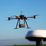
Drones are significant tools in pipeline surveys - get an professional surveyor's insider look at why, and how to optimize the ROI. The following is a guest post by Dustin Price, a licensed land surveyor and the Operations Manager at Landpoint. For pipeline surveys, there's a lot that needs to be considered: speed, accuracy, budget, and safety. Pipeline surveys occur at … [Read more...] about Professional Viewpoint: How Drones Overcome Major Obstacles in Pipeline Surveys
Landpoint
Surveying with Drones: The Key Differences Between Aerial LiDAR and Photogrammetry
The following is a guest post from Dustin Price, licensed land surveyor and operations manager at Landpoint: a surveying, aerial data and technical services provider. There has been an influx of new and, in some cases, game-changing surveying technologies that have popped up over the past few years. Arguably the biggest of these technologies is unmanned aerial vehicles … [Read more...] about Surveying with Drones: The Key Differences Between Aerial LiDAR and Photogrammetry


