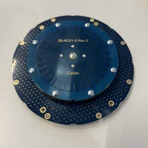
Canadian positioning sensor developer Calian GNSS has launched two advanced antenna solutions designed for precision navigation applications: the HC3990XF housed full-band helical antenna and the next-generation Accutenna 4 antenna family, with the latter showcased at Intergeo 2025. HC3990XF Technical Specifications The HC3990XF helical antenna measures 66.5 mm in base … [Read more...] about From the Floor of Intergeo 2025: Calian GNSS Unveils HC3990XF Helical and Accutenna 4 Antenna Solutions
INTERGEO 2025
GeoCue Expands LP360 with Advanced Visualization Tools
New 3D Model Mesh and Gaussian Splatting Add-Ons Unveiled at INTERGEO 2025 GeoCue has introduced two new visualization features for its LP360 software platform at INTERGEO 2025. The company announced the release of the 3D Model Mesh Add-On and the Gaussian Splatting Add-On, designed to improve realism and deliverable quality for users working with the TrueView GO handheld … [Read more...] about GeoCue Expands LP360 with Advanced Visualization Tools
From the Floor of Intergeo 2025: Phase One Unveils Advanced Drone Camera Systems

Phase One demonstrated comprehensive aerial imaging technologies at Intergeo 2025 in Frankfurt, showcasing new drone camera integration solutions designed for professional geospatial applications. The company announced hardware and software developments targeting surveying, inspection, and mapping operations across multiple UAV platforms. iXM-RS250 Aerial Camera Technical … [Read more...] about From the Floor of Intergeo 2025: Phase One Unveils Advanced Drone Camera Systems
From the Floor of InterGeo 2025: Axpo’s LINIA Software Suite Offers Complete Drone Powerline Inspection Solutions
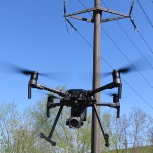
As grid operators worldwide harness drone technology for the crucial, time-and-labor-intensive process of powerline inspection, Swiss power company Axpo has acquired comprehensive in-house systems and now offers these solutions across Europe and worldwide. Axpo showcased their suite of software services at Intergeo 2025, demonstrating tools designed to streamline powerline … [Read more...] about From the Floor of InterGeo 2025: Axpo’s LINIA Software Suite Offers Complete Drone Powerline Inspection Solutions
Phase One Brings P3 Camera to DJI M400, Extending Medium-Format Imaging to New Platform
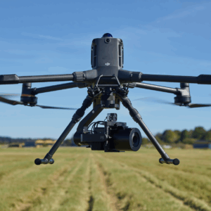
Phase One announced that its P3 drone camera solution is now fully integrated with the DJI M400 platform. This development extends the compatibility that Phase One previously established with DJI’s M350 and M300 series, making its medium-format imaging capabilities accessible to users of DJI’s new flagship inspection drone. What’s New: Seamless Integration & Expanded … [Read more...] about Phase One Brings P3 Camera to DJI M400, Extending Medium-Format Imaging to New Platform


