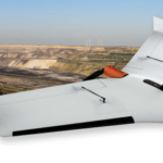
Commercial drone solution provider Delair this week announced the release of an new integration to its Trimble Business Center software. The integration enables geospatial professionals to drag and drop data from the Delair UX11 PPK drone system directly into Trimble Business Center projects. Users can combine high-quality flight data with other sensor data to create … [Read more...] about Delair Expands Drone Data Integration with Trimble Software
Fixed wing drones
Naval Research: New Drone Fueled by the Elements
Groundbreaking military research is giving drones their day in the sun – or at least half a day. The U.S. Naval Research Laboratory is empowering drones to stay aloft more than 12 hours using energy from the sun and wind. Although the research is targeting military applications, the solution is likely to trickle down into commercial sectors in the future. "One of the … [Read more...] about Naval Research: New Drone Fueled by the Elements
New UAVOS Fixed-Wing Drone Offers Easy Setup, Launch
A Silicon Valley drone startup is making on-the-spot drone missions speedier and longer. Mountain Valley-based UAVOS last week announced the launch of the Borey-10 unmanned fixed-wing aircraft, a drone with several new design enhancements that allow a user to assemble the UAV in about 10 minutes. Innovative design features include rechargeable LiIon cell-based batteries … [Read more...] about New UAVOS Fixed-Wing Drone Offers Easy Setup, Launch
Delair Introduces New LiDAR Drone with New Industry Firsts
Delair has been an industry leader for industrial drone solutions for a number of years now - and today they've announced the next generation of high-performance industrial drones with the Delair DT26X LiDAR UAV. It's the first fixed-wing to carry the sophisticated RIEGL LiDAR sensor. Founded in France, Delair has had the advantage of legally flying beyond visual line of … [Read more...] about Delair Introduces New LiDAR Drone with New Industry Firsts
Anywhere, Anytime: Wingtra Drones Map the Alps
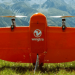
The WingtraOne is an unusual drone, both in looks and functionality. A VTOL (vertical takeoff and landing) design allows the WingtraOne to work in a wide variety of environments. Now xyHt reports that the Wingtra is being used to map the Alps. Swiss engineering firm Cavigelli Ingeniuere AG has been tasked with mapping Lumnezia, a Swiss Alpine valley, for the planning of a … [Read more...] about Anywhere, Anytime: Wingtra Drones Map the Alps


