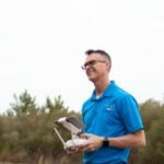
Appeals Court Upholds Ban on Aerial Mapping by Non-Surveyors A three-judge panel of the 4th U.S. Circuit Court of Appeals has ruled that North Carolina can prohibit the creation of aerial maps by anyone other than licensed land surveyors. This decision affects Michael Jones, a drone operator based in Goldsboro, North Carolina, as well as other entrepreneurs in the state. … [Read more...] about North Carolina Drone Operator to Seek Further Review in First Amendment Lawsuit
first amendment rights
Surveyors Wanted to Shut this Drone Photographer Down. Now, He’s Fighting Back. [VIDEO]
Is drone mapping surveying without a license? A First Amendment lawsuit in North Carolina says surveyors cannot stop drone operators from selling photos and making maps. Hiring a surveyor is an expensive buisness, but necessary if you want to establish legal property lines. What if you just want to see what your property looks like, or create a visual map of your property … [Read more...] about Surveyors Wanted to Shut this Drone Photographer Down. Now, He’s Fighting Back. [VIDEO]


