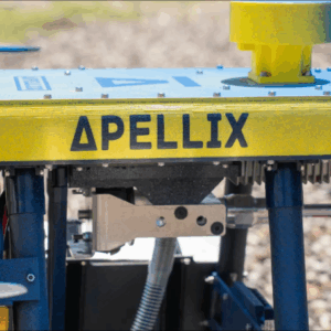
Industrial drone maker Apellix recently announced the launch of its Spray-Painting Drone Beta Program, designed for painting contractors and companies with advanced levels of coating expertise. This initiative allows professionals to leverage drone technology for complex coating applications and includes regular hardware/software updates, direct access to Apellix engineers, and … [Read more...] about Apellix Launches New Beta Program for Spray-Painting Drone
drones in construction
Automating Reality Capture on Job Sites with Drones, Ground Robots, and More: Users Perspective

On the second day of the DroneDeploy conference in Denver, an enterprise panel discussed what automation means on the jobsite - capturing data with automated drones, ground robots, and more. Continue reading below, or listen: DroneLife · Automated - Drones - Ground - Robots - For - Reality - CaptureThis year's DroneDeploy conference has been exciting - not only is the … [Read more...] about Automating Reality Capture on Job Sites with Drones, Ground Robots, and More: Users Perspective
NC DOT to Deploy Remote Drone Operations at Construction Sites: the Path to Routine, BVLOS Inspections

NC DOT Wins FAA Waiver for Remote, BVLOS Ops at Construction Sites Continue reading below, or listen: DroneLife · NC - DOT - Receives - FAA - BVLOS - Waiver - For - Remote - Inspections NC has been a leader in advancing drone operations. Now, the NC DOT announces an FAA waiver to remotely launch and fly drones beyond visual line of sight (BVLOS) to inspect the agency's … [Read more...] about NC DOT to Deploy Remote Drone Operations at Construction Sites: the Path to Routine, BVLOS Inspections
Drone Mapping in Construction: SimActive’s Correlator 3D in the Field in Texas
Drone mapping in construction can provide construction firms with the data they need to make profitable decisions. Chasco Constructors started in Round Rock, TX as a 4-man shop: but today, Chasco is an award winning, full service commercial construction company with over 300 employees. They're using cutting edge technology, including drones and mapping, to monitor … [Read more...] about Drone Mapping in Construction: SimActive’s Correlator 3D in the Field in Texas
Aerial Surveying: DJI Introduces 2 New Powerful Payloads
This week the INTERGEO conference takes place: the world's biggest conference for the geospatial industry. Drones have become such a big part of the geospatial industry that there is now a dedicated section of the show for them: INTERAERIAL Solutions focuses on aerial surveying using drones. At Intergeo today, the world's largest drone manufacturer, DJI announced two new … [Read more...] about Aerial Surveying: DJI Introduces 2 New Powerful Payloads


