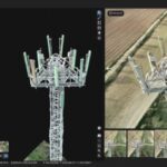
Pix 4D is expanding their enterprise toolset beyond their mapping roots - although the Pix4DMapper platform continues to evolve and improve, staying out ahead of the curve in accuracy and processing time. Now, the company announces the addition of a totally new generation of tools to the Pix4D suite: Pix4Dsurvey, Pix4Dmatic, Pix4Dinspect, and Pix4Dscan. See the video below … [Read more...] about Pix4D Launches Next Gen Suite of Tools [Video]
Drones for Construction
The Latest Wave of Sensor Tech Could be a Game Changer for LiDAR-Equipped Drones
Avalanche photodiode sensors. If you don't know what they are - you need to. The following is a guest post by talented author and self-described nerd Ryan LaDue. The Latest Wave of Sensor Tech Could be a Game-Changer for LiDAR-Equipped UAVs Avalanche photodiode sensors are semiconductors capable of converting photons into electrons with an extremely high level of … [Read more...] about The Latest Wave of Sensor Tech Could be a Game Changer for LiDAR-Equipped Drones
Property Drone Consortium Announces Charter Members
The Property Drone Consortium, a collaboration of insurance carriers, construction industry leaders and supporting enterprises this week announced its roster of charter members. The members, which include Allstate Corporation, American Family Insurance, Auto-Owners Insurance, EagleView Technologies, Inc., Erie Insurance and Pilot Catastrophe Services, have agreed to work … [Read more...] about Property Drone Consortium Announces Charter Members


