
A Look at Flyability Cloud: Streamlined Data Sharing and Secure Collaboration for Indoor Drone Inspection by DRONELIFE Staff Writer Ian J. McNabb Swiss drone manufacturer Flyability recently announced a new, fully integrated cloud service for its Elios 3 indoor-focused mapping drone and software solution. DroneLife got up close and personal with the new offering on the … [Read more...] about Flyability Unveils New Cloud Solution for Elios 3 at InterGEO 2024
drone mapping
Wingtra Unveils MAP61: The Game-Changing Mapping Payload Redefining Survey Efficiency
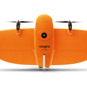
New Payload Slashes Time and Boosts Efficiency for Complex Survey Projects by DRONELIFE Staff Writer Ian J. McNabb At InterGeo this week, Switzerland-based drone manufacturer Wingtra recently announced their new MAP61 mapping payload, which they describe as “the most efficient mapping sensor on the market”. Able to capture up to 1,140 acres in a single flight, the MAP61 is … [Read more...] about Wingtra Unveils MAP61: The Game-Changing Mapping Payload Redefining Survey Efficiency
Going to InterGeo in Germany Next Week? Check These Out!

Spotlight on the Unmanned Systems Stage at InterGEO 2024 InterGEO 2024, taking place from September 24-26 in Stuttgart, Germany, is the premier event for geospatial innovation, offering a diverse platform for professionals in geoinformation, geodesy, and land management. A key highlight of the event is the Unmanned Systems Stage, where the future of drone technology will be … [Read more...] about Going to InterGeo in Germany Next Week? Check These Out!
SimActive’s Correlator3D Used for Mapping in New Zealand’s Challenging Terrain

Drone-based imagery processed for agriculture, environmental assessment, and engineering SimActive Inc.'s Correlator3D™ software is being used by GMAPSNZ to produce high-quality mapping products in New Zealand. GMAPSNZ has been using the software to handle New Zealand’s complex terrain, working in agriculture, environmental assessment, and engineering design. For over a … [Read more...] about SimActive’s Correlator3D Used for Mapping in New Zealand’s Challenging Terrain
FlytBase and Pix4D Partner to Streamline Drone Data Processing Workflows

Integration Simplifies Project Management for Automated Drone Operations FlytBase, a drone autonomy software platform, has announced a strategic partnership with Pix4D, a leading photogrammetry platform for terrestrial and drone mapping. This collaboration aims to streamline drone data processing workflows by allowing FlytBase users to seamlessly upload their drone-captured … [Read more...] about FlytBase and Pix4D Partner to Streamline Drone Data Processing Workflows


