GeoCue, a leading provider of high-accuracy LiDAR mapping hardware and LP360 software, has announced a strategic distribution partnership with JGC Geoinformation System S.A. to bring TrueView LiDAR sensors and LP360 point cloud processing software to Greece, Cyprus, and Balkan countries. Drone LiDAR Mapping Technology for Regional Expansion The partnership positions JGC to … [Read more...] about GeoCue Partners with JGC Geoinformation Systems to Expand LiDAR Mapping Solutions in Greece and Balkans
drone LiDAR
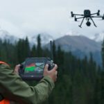
Blue Marble Shows How AI and LiDAR Deliver ROI for Rail Operators

A New Moment for BVLOS Operations Drone operators in the U.S. now have more access to Beyond Visual Line of Sight (BVLOS) waivers than ever before. These waivers allow a single operator to fly longer routes without placing observers along the entire path. The FAA’s recent publication of the BVLOS Notice of Proposed Rulemaking (NPRM) also marks the first step toward routine … [Read more...] about Blue Marble Shows How AI and LiDAR Deliver ROI for Rail Operators
Headed to INTERGEO 2025? Unmanned Systems Take Center Stage in Frankfurt

Exhibitors, product launches, and presentations highlight drones’ expanding role in mapping, monitoring, and emergency response. The world’s largest geospatial event, INTERGEO 2025, returns to Frankfurt from October 7–9, 2025. This year, drones and unmanned systems are in the spotlight across the exhibition floor and conference stages. From new product launches to in-depth … [Read more...] about Headed to INTERGEO 2025? Unmanned Systems Take Center Stage in Frankfurt
DJI Announces New Zenmuse L2 Drone LiDAR: From the Floor of Intergeo
Today, at the InterGeo Show in Berlin, DJI Enterprise featured their new Zenmuse L2 drone Lidar: expanded range, even more accuracy. In a session led by DJI Solution Engineer Kyle Miller, the L2 was on display. With a lot of improvements over the L1, the L2 ups the game for professionals in a wide range of survey use cases. The L2 provides more flexibility, and offers a … [Read more...] about DJI Announces New Zenmuse L2 Drone LiDAR: From the Floor of Intergeo
The World’s Smallest microLiDAR Could Give Drones the Eyes They Need to See Obstacles
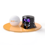
USA based LightWare LiDAR has announced the world's smallest, lightest microLiDAR: the new SF45. Lightware says that the SF45 microLiDAR could provide drones with the "eyes" they need to see obstacles and navigate safely beyond visual line of sight (BVLOS.) LightWare LiDAR "is taking autonomous machines to a whole new level by making them as invincible as they need to be … [Read more...] about The World’s Smallest microLiDAR Could Give Drones the Eyes They Need to See Obstacles


