
New survey-grade sensors offer precision mapping at accessible price points, bringing professional LiDAR technology to a wider audience. by DRONELIFE Staff Writer Ian J. McNabb Alabama-based LiDAR (Light Detection and Ranging) technology developer GeoCue announced their newest additions to their TrueView lineup of sensors- the TV1 and the TV1 Lite. These new, survey-grade … [Read more...] about GeoCue Expands TrueView Lineup with TV1 and TV1 Lite: Affordable, High-Performance LiDAR for Drone Surveys
aerial surveying
GeoCue and Clogworks Technologies Announce Partnership to Expand LiDAR Drone Mapping Solutions
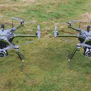
New Collaboration Enhances Aerial Surveying Capabilities with Integrated LiDAR and Software Solutions GeoCue has announced a new partnership with UK-based drone manufacturer Clogworks Technologies Limited. This collaboration integrates GeoCue’s TrueView LiDAR and LP360 software with Clogworks’ Dark Matter series of UAVs. The partnership aims to provide surveyors and mapping … [Read more...] about GeoCue and Clogworks Technologies Announce Partnership to Expand LiDAR Drone Mapping Solutions
Event 38 Unmanned Systems Incorporates Advanced LiDAR Technology into E455 Drone
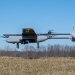
Event 38 Unmanned Systems Integrates Advanced LiDAR onto E455 Drone Event 38 Unmanned Systems, a global leader in the manufacturing of unmanned aerial vehicles, has announced a significant upgrade to their Heavy VTOL E455 Drone. The drone can now be equipped with multiple LiDAR systems, including the Resepi Hesai LIDAR XT-32 developed by Inertial Labs. The integration of … [Read more...] about Event 38 Unmanned Systems Incorporates Advanced LiDAR Technology into E455 Drone
GeoCue and CHC Navigation Unveil TrueView 540: LiDAR Innovation
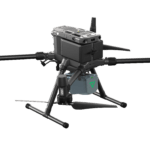
GeoCue and CHC Navigation Unveil TrueView 540 at Geo Week 2024 GeoCue, a leading provider of geospatial hardware and software, and CHC Navigation, a pioneer in precision positioning solutions, have announced the launch of the TrueView 540 at Geo Week 2024. This innovative collaboration introduces a new, efficient, and flexible survey-grade LiDAR system to North America, … [Read more...] about GeoCue and CHC Navigation Unveil TrueView 540: LiDAR Innovation


