- SimActive Software Enhances Construction Mapping for Bullseye Construction
 SimActive’s Correlator3D™ software is being used for real-time mapping on construction projects. SimActive Inc. has announced that its photogrammetry software, Correlator3D™, is being used by Bullseye Construction to map large-scale construction projects. This collaboration allows Bullseye Construction to generate highly accurate map products such as digital surface models (DSMs), point clouds, and orthomosaics. By leveraging… Read more: SimActive Software Enhances Construction Mapping for Bullseye Construction
 - Skydio, Trimble Partner to Bring Centimeter Level Accuracy to the X10
 Skydio and Trimble Collaborate on New Integration for Utilities, Construction and State Transportation Agencies by DRONELIFE Staff Writer Ian J. McNabb Skydio, a California-based drone and UAV manufacturer focused on autonomy, recently announced a new strategic partnership with Trimble to create new integrated workflows designed to unite data capture, data visualization, and data analytics for… Read more: Skydio, Trimble Partner to Bring Centimeter Level Accuracy to the X10
 - US-Based Drone Services Provider FlyGuys Scores $10 Million in Series A to Expand
 Louisiana based drone services provider FlyGuys has scored a $10 million Series A funding round to scale their SaaS solutions platform and expand their nationwide presence. It’s a positive indicator for the US drone industry. Founded in 2014, early player FlyGuys has a nationwide presence, serving enterprise clients in a wide range of industries including agriculture,… Read more: US-Based Drone Services Provider FlyGuys Scores $10 Million in Series A to Expand
 - Automating Reality Capture on Job Sites with Drones, Ground Robots, and More: Users Perspective
 On the second day of the DroneDeploy conference in Denver, an enterprise panel discussed what automation means on the jobsite – capturing data with automated drones, ground robots, and more. Continue reading below, or listen: DroneLife · Automated – Drones – Ground – Robots – For – Reality – CaptureThis year’s DroneDeploy conference has been… Read more: Automating Reality Capture on Job Sites with Drones, Ground Robots, and More: Users Perspective
 - NC DOT to Deploy Remote Drone Operations at Construction Sites: the Path to Routine, BVLOS Inspections
 NC DOT Wins FAA Waiver for Remote, BVLOS Ops at Construction Sites Continue reading below, or listen: DroneLife · NC – DOT – Receives – FAA – BVLOS – Waiver – For – Remote – Inspections NC has been a leader in advancing drone operations. Now, the NC DOT announces an FAA waiver to remotely… Read more: NC DOT to Deploy Remote Drone Operations at Construction Sites: the Path to Routine, BVLOS Inspections
 - Indoor Inspections, Concrete Repair Spray, and More: Japan Drone and International Advanced Air Mobility EXPO
 This article published in collaboration with JUIDA, the Japan UAS Industrial Development Association. Japan Drone/International Advanced Air Mobility EXPO 2023 by DRONELIFE Staff Writer Ian J. McNabb The “Japan Drone/International Advanced Air Mobility EXPO 2023”, sponsored by JUIDA at the Makuhari Messe convention center in Chiba City, ended on June 26th after three days of… Read more: Indoor Inspections, Concrete Repair Spray, and More: Japan Drone and International Advanced Air Mobility EXPO
 - DroneDeploy Conference: The Future is Here
 At this week’s DroneDeploy conference, DroneDeploy co-founder Mike Winn says that despite the challenges of 2020, the future of drone mapping, and the drone community, is here. In an opening address, Winn presented a fascinating view of the worksite of the future, using the construction industry as an example. “Almost every industry involves construction of… Read more: DroneDeploy Conference: The Future is Here
 - Pix4D announces Stand-Alone Photogrammetry with Cloud Processing
 Pix4D launches stand-alone photogrammetry cloud processing solutions Lausanne, Switzerland, June 9th, 2020: Pix4D, the photogrammetry and drone-mapping industry leader, announces today the release of Pix4Dcloud and Pix4Dcloud Advanced: the new mapping platforms for online surveying workflows and construction site monitoring. These stand-alone cloud products run Pix4D’s photogrammetry algorithms for mapping and modeling reality from images. Pix4Dcloud Advanced extends the functionalities… Read more: Pix4D announces Stand-Alone Photogrammetry with Cloud Processing
 - DJI Mavic Air 2 Announcement: Today is the Day
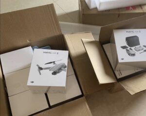
 DJI Mavic Air 2 Announcement is scheduled for today. The long anticipated and often rumored DJI Mavic Air 2 announcement will occur tonight – we think. DJI is going to announce something later today, April 27 at 9:30 pm EDT, or the webmaster is going to have some explaining to do. The Brazilian certification body… Read more: DJI Mavic Air 2 Announcement: Today is the Day
 - DRONELIFE Exclusive: How Drones Will Change Power Line Stringing Forever
 Drones have been used in the power industry for a few years now, but in the U.S., power line stringing is a relatively new application. It’s an application that offers massive cost and time savings – and is one that could permanently change the way power companies work. DRONELIFE spoke with Matt Dunlevy, President and… Read more: DRONELIFE Exclusive: How Drones Will Change Power Line Stringing Forever
 - Research Says Small Drone Market in U.S. Worth 22.55 Billion by 2026: but Which Region Will Grow the Fastest?
 The market for small drones is projected to reach $22.55 billion by the end of 2026, according to a report recently released by Fortune Business Insights. In a paid analysis study titled “Small Drones Market Size, Share & Industry Analysis, by Type (Fixed-Wing, Rotary-Wing, and Hybrid/Transitional), By Power Source (Lithium-ion cells, Hybrid Fuel cells, and Solar… Read more: Research Says Small Drone Market in U.S. Worth 22.55 Billion by 2026: but Which Region Will Grow the Fastest?
 - DRONELIFE Exclusive: Ware CEO Ian Smith on the Next Big Vertical for Commercial Drones
 The drone industry excels at addressing expensive and slow processes that can be dramatically improved with aerial assets. One San Francisco startup has identified a major need in a $1.9 trillion industry, and they’re solving it with a combination of easily available commercial hardware and their own sophisticated software systems. Ware announced a new drone-based… Read more: DRONELIFE Exclusive: Ware CEO Ian Smith on the Next Big Vertical for Commercial Drones
 - Drone Company Ware Introduces Inventory Management to Support 1.9 Trillion Warehousing Industry
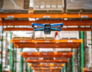
 San Francisco drone startup Ware is using Skydio drones and sophisticated sftware to handle inventory tracking for the warehouse industry. Inventory tracking is both labor intensive and time-consuming: making it a perfect target for robotic assistance. The Ware solution uses a drone to capture images of warehouse bins and then uses machine learning algorithms to… Read more: Drone Company Ware Introduces Inventory Management to Support 1.9 Trillion Warehousing Industry
 - Flyability Flies Into the US with a New Office and A User Conference
 Swiss-based Flyability is opening a office in the U.S.: and offering its first-ever U.S.- based user conference. Flyability has a unique drone platform that is normally used indoors, performing applications that are difficult and dangerous for people to do. We have written recently about Flyability in a partnership with Pix4D, and an interview with their… Read more: Flyability Flies Into the US with a New Office and A User Conference
 - DroneLife Exclusive: Azur Drones – This Security Guard is On Duty 24/7, Patrolling Dunkirk Port
 France’s Azur Drones offers a truly autonomous, drone in a box solution for security. It’s a powerful and sophisticated system designed to secure critical infrastructure – and with French approval to fly autonomously beyond visual line of sight, Azur is poised to be Europe’s leading player in security drones. Azur Drones is now providing their… Read more: DroneLife Exclusive: Azur Drones – This Security Guard is On Duty 24/7, Patrolling Dunkirk Port
 - Aerodyne Acquires Measure’s Inspection Services Business
 Measure’s inspection services business has been acquired by Asia Pacific company Aerodyne, forming a new joint venture entity – Aerodyne Measure – for drone services. Measure will continue to operate independently as an enterprise software provider: Measure CEO Brandan Declet Torres comments that the partnership will significantly expand the user base of Measure Ground Control. The… Read more: Aerodyne Acquires Measure’s Inspection Services Business
 - SimActive Adds New LiDAR Workflow Functionality
 SimActive has just announced some additional functionality removes some of the manual processes currently needed to process softificated imagery. From their press release below: “Removing the need to manually tag GCPs facilitates the integration of LiDAR data with imagery”, said Dr Philippe Simard, President of SimActive. “Our clients can benefit from different data sources, with… Read more: SimActive Adds New LiDAR Workflow Functionality
 - Skywatch.AI Partners with Parazero: Drone Pilots Save Money on Insurance with Safety Systems
 Two players in the commercial drone space have just announced a partnership to help reduce insurance costs for commercial drone pilots. It’s a partnership that makes sense – an InsurTech platform that’s all about quantifying risks, and a developer of drone safety systems proven to significantly reduce those risks: these two Israeli startups are joining… Read more: Skywatch.AI Partners with Parazero: Drone Pilots Save Money on Insurance with Safety Systems
 - Drone Software Used To Help Survey Damage After Hurricane Dorian
 In another example of drones being integrated in the way that the world does business, SimActive the Canadian based provider of photogrammetry software announced that their software was used to help determine the impact of the most recent Hurricane Dorian. The provider details how they helped to determine financial impact of the recent hurricane… Read more: Drone Software Used To Help Survey Damage After Hurricane Dorian
 - The Skydio 2 Dock Aims to Make Fully Autonomous Workflows a Reality
 Earlier this month the highly anticipated Skydio 2 landed, revamping the original R1 and sending a clear message to hobbyist drone pilots and professionals: You don’t have to fly with DJI. Aside from all the bells and whistles of the new release – which include (still) unmatched computer vision, an improved camera, longer flight time,… Read more: The Skydio 2 Dock Aims to Make Fully Autonomous Workflows a Reality
- Skip to main content
- Skip to secondary menu
- Skip to primary sidebar
- Skip to secondary sidebar
- Skip to footer
Footer
SPONSORED


