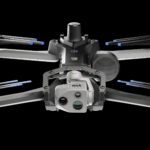
Skydio and Trimble Collaborate on New Integration for Utilities, Construction and State Transportation Agencies by DRONELIFE Staff Writer Ian J. McNabb Skydio, a California-based drone and UAV manufacturer focused on autonomy, recently announced a new strategic partnership with Trimble to create new integrated workflows designed to unite data capture, data visualization, and … [Read more...] about Skydio, Trimble Partner to Bring Centimeter Level Accuracy to the X10
Surveying
GeoCue Partners with Tediris to Integrate TrueView 3D Imaging with Aero 4 Drone
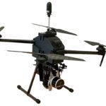
GeoCue and Tediris Solutions Partner to Provide Spain with Aerial Mapping Solutions by DRONELIFE Staff Writer Ian M. Crosby LiDAR mapping leader GeoCue has announced a new partnership with Spanish drone service provider Tediris Solutions. With close to a decade of experience in the UAV market, Tediris Solutions integrates sophisticated sensors, drones, and artificial … [Read more...] about GeoCue Partners with Tediris to Integrate TrueView 3D Imaging with Aero 4 Drone
Virtual Surveyor Releases Newest Version of Smart Drone Surveying Software: Now with Photogrammetry
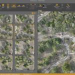
Virtual Surveyor Releases New Photogrammetry App: Completing Drone Survey Workflow Continue reading below, or listen: DroneLife · Virtual - Surveyor - Adds - Photogrammetry - To - Drone - Surveying - Package by DRONELIFE Staff Writer Ian M. Crosby Software company Virtual Surveyor has updated the newest version of its smart drone surveying software to include drone … [Read more...] about Virtual Surveyor Releases Newest Version of Smart Drone Surveying Software: Now with Photogrammetry
Inspecting Wind Turbines Without Stopping Them: Japanese Company Demos Drone Technology

This article published in collaboration with JUIDA, the Japan UAS Industrial Development Association Japanese Company Showcases First Non-Stop Wind Turbine Inspection Technology Using Drones by DRONELIFE Staff Writer Ian J. McNabb At the Tsukaba Forum recently held in Japan, Tokyo-based Nippon Telegraph and Telephone Corporation (NTT) recently unveiled new technology for … [Read more...] about Inspecting Wind Turbines Without Stopping Them: Japanese Company Demos Drone Technology
Mapping Paradise: Event 38 and PLACE Partner to Map Turks and Caicos

Event 38 and PLACE Partner to Map Turks and Caicos Islands Using E400 Drones by DRONELIFE Staff Writer Ian M. Crosby Mapping drone manufacturer Event 38 Unmanned Systems has announced the successful deployment of its E400 fixed-wing mapping drone for the collection of aerial imagery and mapping data in Turks and Caicos, which had not been mapped in at least ten years. In only … [Read more...] about Mapping Paradise: Event 38 and PLACE Partner to Map Turks and Caicos


