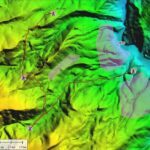
Top New Features in Global Mapper v25 Continue reading below, or listen: DroneLife · Blue - Marble - New - Features - Global - Mapper - Pro Blue Marble Geographic’s flagship software, Global Mapper Pro, is an all-in-one GIS package for analyzing and processing vector, terrain, image, and point cloud data. A comprehensive and easy-to-use GIS application that provides an … [Read more...] about Check Out These New Features in Global Mapper v25 from Blue Marble
Sponsored Content
Global Mapper Mobile: Streamlining Data Collection and Processing
Streamline Data Collection and Processing with Global Mapper Mobile By Amanda Lind The following article is sponsored content. Streamline your field-to-office workflow by taking advantage of Global Mapper Mobile’s ability to collect high-accuracy vector data in the field. Continue reading below, or listen: DroneLife · Blue - Marble - Global - Mapper - Mobile Available on … [Read more...] about Global Mapper Mobile: Streamlining Data Collection and Processing
CrewID™: Giving Drone Teams the Identification and Access They Need
Beyond the Yellow Vest: CrewID™ is the Real ID for Drone Operators The drone industry is ready to scale. Drones are increasingly visible on worksites that range from construction to telecomm, and in residential areas for applications like delivery or power line maintenance. Continue reading below, or listen: DroneLife · CrewID - Giving - Unmanned - Operations - Teams - The … [Read more...] about CrewID™: Giving Drone Teams the Identification and Access They Need
DroneUp and Elsight Halo: Connectivity for Large Scale Drone Delivery
Reliable Connectivity for Large-Scale Drone Delivery Services: DroneUp and Elsight Halo Continue reading below, or listen: DroneLife · Reliable - Connectivity - Is - Key - To - Wide - Scale - Drone - Delivery - Case - StudyIn an new case study by Elsight, DroneUp and Elsight Halo: how robust communications supports DroneUp's command and control capabilities for their … [Read more...] about DroneUp and Elsight Halo: Connectivity for Large Scale Drone Delivery
Global Mapper Mobile: New GNSS Device Support
Introducing Global Mapper Mobile’s New GNSS Device Support via TCP/IP Communication Global Mapper Pro is a powerful geospatial data analysis program that contains tools for everything from raster image processing to photogrammetric point cloud creation with the Pixels to Points tool. Designed to work alongside Global Mapper Pro, the free iOS and Android Global Mapper Mobile … [Read more...] about Global Mapper Mobile: New GNSS Device Support


