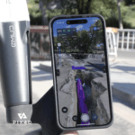
Latest update integrates professional augmented reality tools for improved precision in AEC sectors. Swiss-based Pix4D, a leading provider of drone and terrestrial mapping solutions, announced today the release of the upgraded version of their mobile scanning app, PIX4Dcatch 2.0. This update introduces augmented reality (AR) capabilities and expands compatibility with … [Read more...] about Pix4D Releases Enhanced PIX4Dcatch 2.0 with AR Features
Imaging
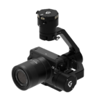
Gremsy Launches Pixy LR: Gimbal for New Sony ILX-LR1 Camera
Gremsy, a leading manufacturer of camera gimbal stabilizers for drones, announces the Pixy LR: a purpose-built gimbal for the Sony ILX-LR1. The Sony ILX-LR1 is a major release for the drone industry: a 61 MP full-frame mirrorless camera in a small, lightweight form factor. Sony's SDK enable more features and better performance for aerial surveying and inspection. "Pixy … [Read more...] about Gremsy Launches Pixy LR: Gimbal for New Sony ILX-LR1 Camera
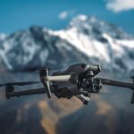
DJI Launches Air 3 Drone: Dual Cameras, Omnidirectional Obstacle Sensing
DJI Introduces Air 3 Drone: Powerful Addition to the Air Series Dual Primary Cameras, Up To 46 Minutes Flight Time, Omnidirectional Obstacle Sensing and O4 HD Video Transmission DJI continues to raise the bar for small drones. Today, DJI launched the Air 3: with a wide-angle camera and a 3x medium tele camera. The Air 3 is an aerial photography hobbyists dream - and a … [Read more...] about DJI Launches Air 3 Drone: Dual Cameras, Omnidirectional Obstacle Sensing
Drones and High Resolution Lenses Protect Wildlife Around the World: Quantum Systems and Wilderness International in Peru
Drones equipped with high resolution lenses are a powerful tool in the fight to protect wildlife around the world. Here, Yasuo Baba of Sony Digital Imaging gives us the specifics of the project between Quantum-Systems and Wilderness International. The following is a guest post by Yasuo Baba, Director, Digital Imaging and European Product Marketing, Sony Digital Imaging … [Read more...] about Drones and High Resolution Lenses Protect Wildlife Around the World: Quantum Systems and Wilderness International in Peru
CHEESEHEAD Drone Project May Improve Climate Models
What do the Green Bay Packers and forest-scanning drones have in common? Cheeseheads. While Packer fans proudly identify with the dairy-infused moniker, a research project at the University of Wisconsin-Madison has adapted the name for a ground-breaking UAV project to improve weather forecasting by understanding how vegetation and forests influence the … [Read more...] about CHEESEHEAD Drone Project May Improve Climate Models

