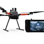
LiDAR Pros Expands Services and Drone Reselling in Southwest Region The integration of LiDAR technology into commercial drone operations continues to revolutionize industries such as architecture, surveying, construction, and public safety. The precision and efficiency offered by LiDAR have prompted significant advancements in data collection, enabling companies to … [Read more...] about The LiDAR Pros: Comprehensive LiDAR Drone Services from the Experts of Sundance Media Group
Sensors
Event 38 Unmanned Systems Incorporates Advanced LiDAR Technology into E455 Drone
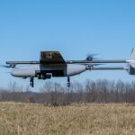
Event 38 Unmanned Systems Integrates Advanced LiDAR onto E455 Drone Event 38 Unmanned Systems, a global leader in the manufacturing of unmanned aerial vehicles, has announced a significant upgrade to their Heavy VTOL E455 Drone. The drone can now be equipped with multiple LiDAR systems, including the Resepi Hesai LIDAR XT-32 developed by Inertial Labs. The integration of … [Read more...] about Event 38 Unmanned Systems Incorporates Advanced LiDAR Technology into E455 Drone
Revolutionizing Non-Destructive Testing with Drones: Flyability Teases Groundbreaking New Product

Flyability to Unveil Groundbreaking Product at 2024 User Conference Flyability, the industry leader in confined-space drones, has announced the launch of a new product at their 2024 User Conference on March 6th. The event will be broadcast live and covered by Flyability’s media partner, the Chartered Institution of Civil Engineering Surveyors (CICES). The new product, a … [Read more...] about Revolutionizing Non-Destructive Testing with Drones: Flyability Teases Groundbreaking New Product
Revolutionising Flood and Drought Management: Radar Drones Could Redefine Soil Moisture Monitoring
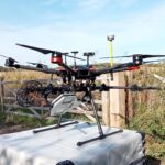
Radar Drones Transform Soil Moisture Monitoring: Cranfield University Leads Innovation for Flood and Drought Management Cranfield University is spearheading a groundbreaking two-year project aimed at revolutionizing soil moisture monitoring through the fusion of Synthetic Aperture Radar (SAR) and unmanned aerial vehicles (UAVs). Synthetic Aperture Radar utilizes radio … [Read more...] about Revolutionising Flood and Drought Management: Radar Drones Could Redefine Soil Moisture Monitoring
MatrixSpace on the Drone Radio Show: Getting to Drone-as-a-First-Responder 2.0 with Smaller, More Powerful Sensors
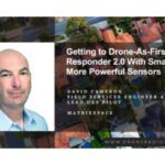
Don't miss this episode: MatrixSpace on the Drone Radio Show with host Randy Goers. David Cameron, Field Services Engineer and Lead UAS Pilot at MatrixSpace, talks about the evolution of drone as first responder programs and how MatrixSpace sensors can improve safety and operational efficiency of future DFR missions. Drone Radio Show · Getting to Drone-As-First-Responder … [Read more...] about MatrixSpace on the Drone Radio Show: Getting to Drone-as-a-First-Responder 2.0 with Smaller, More Powerful Sensors


