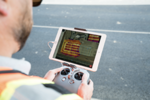
 Four months after releasing a real-time UAV mapping solution, software startup DroneDeploy is enhancing the system with the release of Thermal Live Maps.
In February, the company launched Live Map, a product described as the “only real-time drone mapping solution in the world.” Thermal Live Maps, DroneDeploy officials say, now allows users to generate thermal drone maps locally to iOS devices from DJI drones in real-time flights.
“Thermal Live Map puts the latest advancements in edge computing and image processing to work for our customers in real-time,” DroneDeploy CTO Nicholas Pilkington said. “Now they can make immediate decisions from thermal maps and gain actionable insights to improve site safety.”
Outfitted with thermal cameras and sensors, drones can trouble-shoot a variety of problems across several industries including agriculture, solar, construction and roofing.
“Thermal inspections have been limited to accessible areas or required manned aircraft that typically yield low-resolution data at a high price” a company blog stated. “Today, that all changes.”
With enhanced features, Thermal Live Maps eliminates the need to upload and process thermal imagery, allowing users faster access to data resulting in quicker decision-making.
“Rather than searching for a needle in a haystack, you have a map to tell you right where to look. The work input to value output with drone-based thermal imagery is game-changing,” Grant Hagen, Virtual Design and Construction Manager at The Beck Group, said. “It’s unlike anything else in construction technology right now.”
For agricultural concerns, Thermal Live Map helps farmers spot crop stress issues in real time, easily identifying irrigation issues, premature ripeness, and plant disease.
The new launch comes on the heels of DroneDeploy’ s recent release of Progress Photos, a solution designed to simplify site documentation and reporting. The company bills it as the “first solution to automate visual site documentation throughout the life cycle of a project.”
In early June, DroneDeploy also launched a new line of drone-centric organizational apps, enhancing the company’s Progress Photo reports.
“We’ve enhanced our platform capabilities to make drone data more accessible to our customers,” a company spokesperson stated. The new app functionality will allow DroneDeploy users to install any public app pre-loaded into their accounts.
In 2016, the company created App Market, a drone-data hub offering more than 75 public apps across 10 industries.
Jason is a longstanding contributor to DroneLife with an avid interest in all things tech. He focuses on anti-drone technologies and the public safety sector; police, fire, and search and rescue.
Beginning his career as a journalist in 1996, Jason has since written and edited thousands of engaging news articles, blog posts, press releases and online content.
Email Jason
TWITTER:@JasonPReagan
Subscribe to DroneLife here.


[…] post DroneDeploy Upgrades Live Map Platform for Better UAV Imaging appeared first on […]