

Large UAS from MSU’s Raspet Flight Research Lab Provide Real-Time Data to Support Hurricane Helene Response and Flood Modeling Efforts in Collaboration with Federal Partners
by DRONELIFE Staff Writer Ian J. McNab
Mississippi State University’s drones are flying a little further away from Starkville than usual, as they’re being deployed to Georgia for hurricane relief efforts in support of FEMA’s Hurricane Helene response.

With funding from the Department of Homeland Security Science and Technology Directorate’s Project JUSTICE, MSU’s pilots, engineers and scientists from the Raspet Flight Research Laboratory and the Northern Gulf Institute deployed to Georgia Sept. 29 for UAS flights over impacted areas in the Southeast. According to the press release, “(b)y outfitting Raspet’s large uncrewed aircraft with sophisticated sensors and cameras, MSU personnel provide real-time data and visuals on where floodwaters are moving to partners like FEMA Region 4 and the National Oceanic and Atmospheric Administration.”
“I am extremely proud that MSU’s UAS capabilities are supporting our federal partners as they carry out critical missions to protect lives and property,” said Bryan Farrell, interim director of the Raspet Flight Research Lab. “This deployment comes after years of collaboration and successful training exercises. These efforts highlight the many ways large UAS can support emergency response, and how our research centers here at MSU work together to deliver new capabilities to our stakeholders. The effort not only provides immediate data for decision-makers, but the lessons learned influences future research directions.”
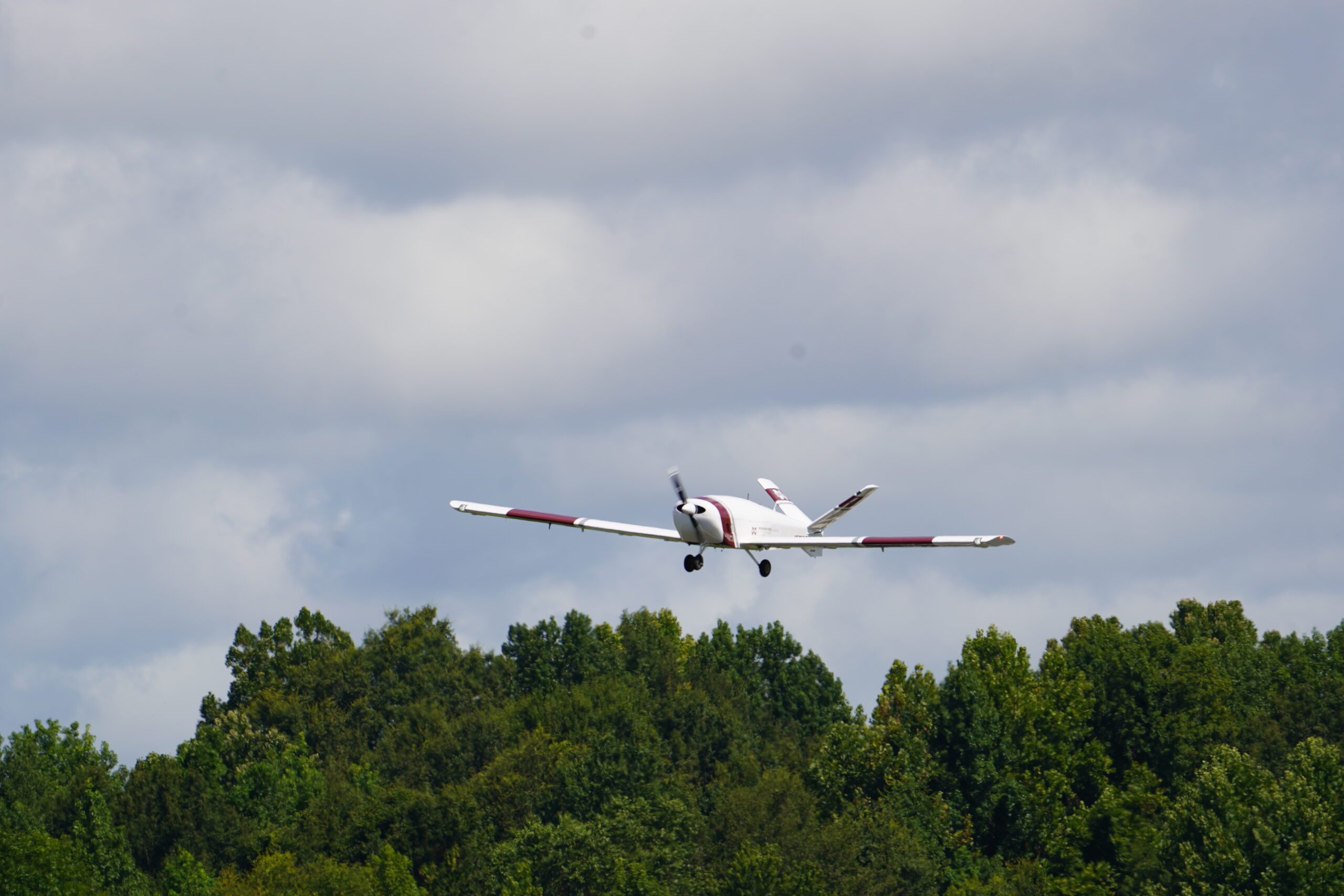
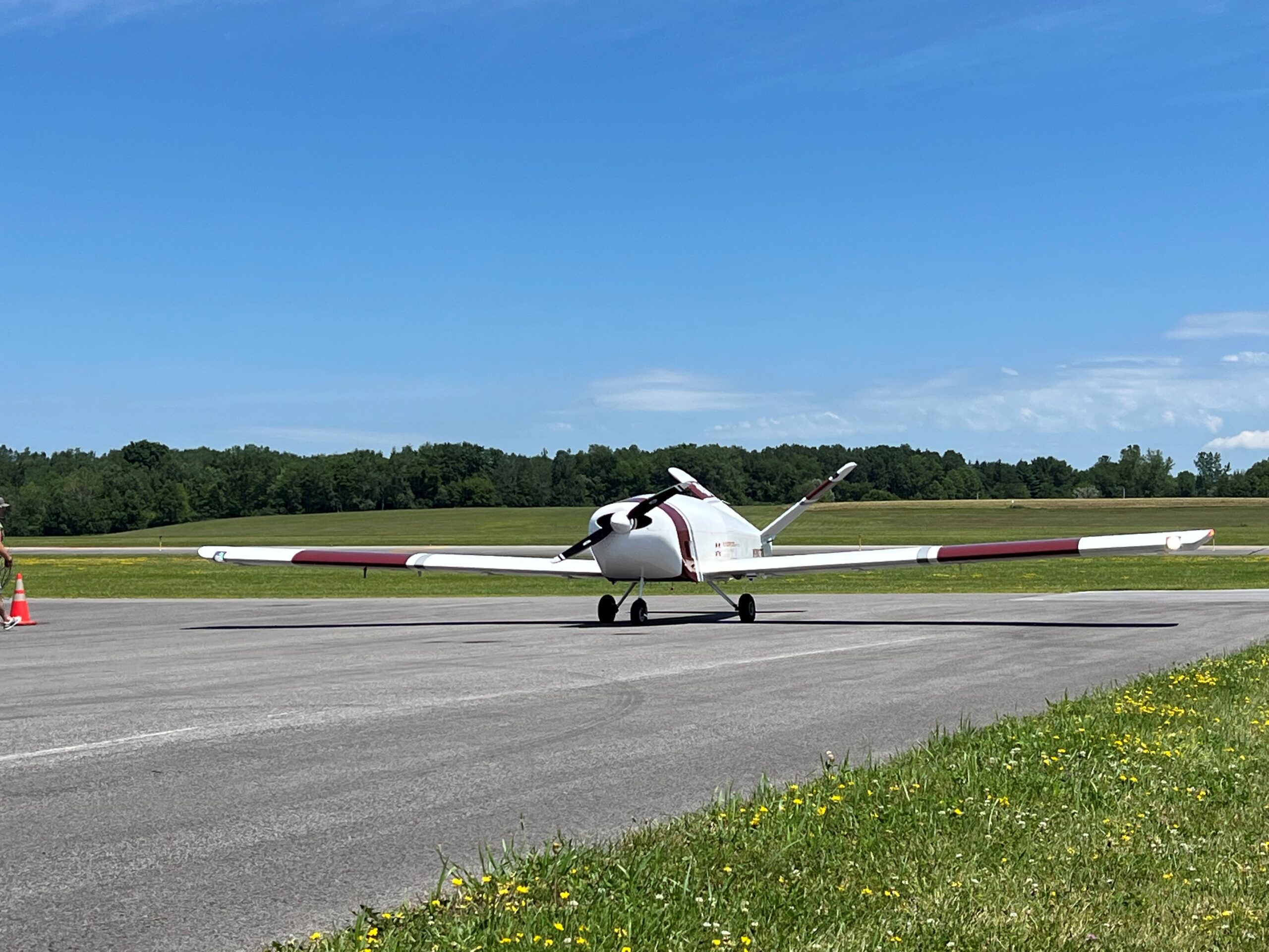
To assist in the recovery efforts, the Raspet team is using their largest, most powerful UAV- the Navmar Applied Sciences Corporation Teros. Capable of flying for more than 20 hours and built with a 44-foot wingspan, the Teros can effectively carry large payloads that feed data and video to emergency operations commands in collaboration with FEMA.
MSU’s Northern Gulf Institute, a NOAA Cooperative Institute, has led research efforts to improve flood modeling and river forecasting by leveraging data and imagery collected during UAS flights, leading to the development and refinement of new flood response capabilities in collaboration with federal partners. According to the press release, NGI geoscience experts have been following Hurricane Helene and its path up the Gulf of Mexico and states such as Florida, Georgia, South Carolina, North Carolina and Tennessee.

“Once a hurricane has passed over an inland area, the water it leaves behind is constantly moving, and that movement can be difficult to predict, especially in places where trees and other barriers might obscure water from satellite imagery,” said Jamie Dyer, MSU geosciences professor and NGI associate director. “UAS allow us to see in better detail where water is going and which areas will be impacted by flooding, which is vital information to have during a crisis event. Additionally, the data we collect will improve the river forecasting models that local, state and federal officials rely on.”
MSU’s Raspet Flight Research Lab boasts the country’s largest fleet of uncrewed aircraft systems, or UAS, in academic use, and recently celebrated its 75th year of aviation research.
Working in collaboration with MSU faculty, students and other research centers, Raspet leads major UAS research, testing and evaluation efforts on behalf of the U.S. Department of Homeland Security and Defense. For more, click here.
The Northern Gulf Institute works to improve ecosystem management for the Gulf of Mexico with research that builds an integrated, comprehensive understanding of natural and human impacts on Gulf of Mexico ecosystems and economies. For more, click here.
Read more:
- Airborne Response Onboards Over 100 Drone Pilots to Help Combat Rapid Intensification Threat from Hurricanes
- Drones for Hurricane Ian Recovery: Airborne Response Completes More than 500 Flights
- KDDI and Japan Airlines Successfully Test Multi-Drone System for Disaster Relief


Miriam McNabb is the Editor-in-Chief of DRONELIFE and CEO of JobForDrones, a professional drone services marketplace, and a fascinated observer of the emerging drone industry and the regulatory environment for drones. Miriam has penned over 3,000 articles focused on the commercial drone space and is an international speaker and recognized figure in the industry. Miriam has a degree from the University of Chicago and over 20 years of experience in high tech sales and marketing for new technologies.
For drone industry consulting or writing, Email Miriam.
TWITTER:@spaldingbarker
Subscribe to DroneLife here.