
New Receptor AI System Boosts Autonomous Navigation and Image Recognition for GNSS-Denied Environments
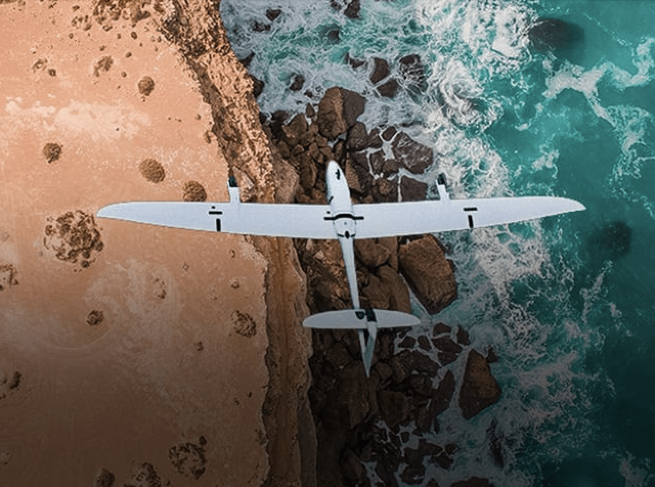
German reconnaissance drone developer Quantum Systems recently announced that they had recently begun testing an upgrade to their “Receptor AI” multi-sensor system in Ukraine. This Jetson Orin Nvidia powered-AI system includes several sensors for the Vector reconnaissance drone that allow for enhanced autonomous obstacle avoidance and image recognition, allowing the Vector to complete complex reconnaissance missions independently.

Due to the increasing importance of maintaining reliability in difficult GNSS-denied environments, this new upgrade provides new options for signal-independent positioning of reconnaissance drones, vastly increasing their GNSS denied capabilities. According to the press release, the new module is being tested and further developed at the company’s recently opened development site in Ukraine.
“We are implementing the upgrade without any weight changes and with the same range,” says Daniel Kneifel, Director of Software Engineering at Quantum Systems. “We are designing these adaptations without fundamental changes to the existing platform architecture.”
The Vector is specially designed as a long-range reconnaissance drone for both commercial and government clients. In 2022, Quantum Systems announced that it had signed an acquisitions deal with the Ukrainian Ministry of Defense to send Vectors to aid in the ongoing conflict. Producing very little noise in flight, the Vector is designed to be easily integrated into existing operations, requiring only 4 days of additional training to operate effectively in the field. When deployed, it streams high-definition video over an encrypted stream, providing enhanced situational awareness in difficult conditions.
Other projects have included wildlife conservation efforts in Peru, where they partnered with Wilderness International to use their commercial F90+ to take high-definition photos of vulnerable forest ecosystems. This allows the nonprofit organization to monitor over 5 million square meters of jungle for threats such as poaching or illegal deforestation, continued threats to the regions biodiversity.
The original press release is available here.
Read more:
- Quantum-Systems Awarded AUD $90 Million Contracts by Australian Defence Force
- Transforming Mining Operations with Drones: Strayos Partners with Quantum Systems
- Drones for Ukraine: Quantum Systems Sends Long Endurance Vectors


Miriam McNabb is the Editor-in-Chief of DRONELIFE and CEO of JobForDrones, a professional drone services marketplace, and a fascinated observer of the emerging drone industry and the regulatory environment for drones. Miriam has penned over 3,000 articles focused on the commercial drone space and is an international speaker and recognized figure in the industry. Miriam has a degree from the University of Chicago and over 20 years of experience in high tech sales and marketing for new technologies.
For drone industry consulting or writing, Email Miriam.
TWITTER:@spaldingbarker
Subscribe to DroneLife here.